National Cycle Network
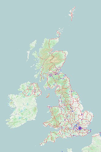
In 2020, around a quarter of the NCN was scrapped on safety grounds,[1] leaving 12,739 miles (20,501 km) of signed routes.
[2] It uses shared use paths, disused railways, minor roads, canal towpaths and traffic-calmed routes in towns and cities.
[4] The original goal was to create 5,000 miles (8,000 km) of signposted cycle routes by 2005,[3] with 50% of these not being on roads, and all of it being "suitable for an unsupervised twelve year old."
[1] As of July 2020[update], there were 12,739 miles (20,501 km) of signed cycle and walking route that are part of the Network.
One thousand "Millennium Mileposts" made from cast iron were funded by the Royal Bank of Scotland to mark the creation of the National Cycle Network, and these are found along the NCN routes throughout the UK.
Following the de-designation of approximately a quarter of the NCN in 2020,[1] a significant number of the mileposts are now orphaned from their intended routes.
They form part of the Millennium Time Trail, a treasure hunt puzzle created by Sustrans in 2001.