National Water Carrier of Israel
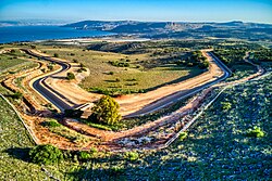
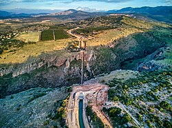
[3] The carrier consists of a system of giant pipes, open canals, tunnels, reservoirs and large scale pumping stations.
It was forecast that by 2010, 80% of the output would be used for drinking water for two reasons: rapid population growth, primarily in the center of the country, and higher living standards.
[1]Under the 1994 Israel-Jordan Treaty of Peace, Israel agreed to transfer 50 million cubic metres of water annually to Jordan.
This has lessened the country's reliance on the National Water Carrier and has allowed it to significantly reduce the amount of water pumped from the Sea of Galilee in an effort to restore and improve the lake's ecological environment, especially in face of severe droughts affecting the lake's intake basin in previous years.
[1] The Beit Netofa Canal takes the water 17 kilometers and was built with an oval base due to the clay soil through which it runs.
The advanced Eshkol Water Filtration Plant, completed in 2007-2008 by Mekorot,[8] the fourth largest in the world,[9] is located at the southwestern edge of the Beit Netofa Valley.
At the end of the filtration process the water enters the 108" Pipeline, which transports it 86 km to the Yarkon-Negev system near the city of Rosh HaAyin to the east of Tel Aviv and Petah Tikva.
[1] An earlier water development scheme was proposed by Walter C. Lowdermilk in his book Palestine, Land of Promise, published in 1944.
The book became a bestseller, and important in swaying the debate within the Truman administration concerning immigrant absorptive capacity and the Negev as part of Israel.
The Hayes plan was designed to be implemented in two stages over a 10-year period, but never materialised due to its economic infeasibility and lack of cooperation by Jordan.
[11][12] In 1964, Syria attempted construction of a Headwater Diversion Plan that would have prevented Israel from using a major portion of its water allocation,[qt 2] sharply reducing the capacity of the carrier.
[13] This project and Israel's subsequent physical attack on those diversion efforts in 1965 were factors which played into regional tensions culminating in the 1967 Six-Day War.
The surface of the Dead Sea has shrunk by about 33% since the 1960s, which is partly attributed to the much-reduced flow of the Jordan River since the construction of the National Water Carrier project.
At Ein Gedi for instance, on the western coast of the Dead Sea, a large number of sinkholes have appeared in the area, which have even damaged a highway segment built in 2010, supposedly to a "sinkhole-proof" design.
[15] The Dead Sea is further shrinking due to the diminished amount of water from the rains reaching it since flash floods started pouring into the sinkholes.