New Jersey Route 31
There were plans made in the late 1960s and early 1970s to build a freeway in the Route 31 corridor that would begin in the Trenton area and extend as far north as Interstate 84 (I-84) in Port Jervis, New York; however, it was canceled in the mid-1970s due to opposition from area residents and environmental and financial constraints.
The route passes by residences and some businesses in the northern part of Trenton, crossing the intersection with Calhoun Street (CR 653).
[1][2] The route continues north through suburban residential areas and passes to the west of the TCNJ campus.
The route briefly skirts into Pennington twice, where it is a divided highway as it crosses over CSX's Trenton Subdivision railroad line.
[1] Upon crossing the intersection with Lambertville–Hopewell Road (CR 518), Route 31 enters East Amwell, Hunterdon County, and continues through rural areas.
The road becomes a divided highway and crosses entirely into East Amwell again before it comes to an interchange with US 202, where CR 579 continues north into Ringoes and Route 31 heads north along US 202, a four-lane, divided highway with intersections featuring jughandle ramps.
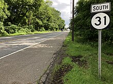
[3] The road continues north through farms, reaching commercial development as it approaches the Flemington area.
[1] The route crosses back into Raritan Township, where it passes under the Black River & Western Railroad and briefly becomes a four-lane divided highway before reentering Flemington.
Route 31 passes through suburban development before turning into a four-lane, divided highway with some intersections controlled by jughandles and crossing over Norfolk Southern Railway's Lehigh Line and the South Branch of the Raritan River into Readington.
Route 31 passes through Glen Gardner, which it enters upon crossing Sprunce Run, before heading into Hampton, where it heads west through that community as a three-lane road with two southbound lanes and one northbound lane and passes over an abandoned railroad line.
Past the intersection with Washington Avenue (Route 57), Route 31 narrows to three lanes, passing under the Dover and Delaware River Railroad line, and becomes a two-lane road again as it crosses back into Washington Township at the intersection with Essex Road.
[1][2] Before the state received ownership of Route 31, the portion of the highway from Clinton to Oxford was part of the Spruce Run Turnpike.
[5] The turnpike served as a connector along the old Hopewell Road from modern-day Lambertville (then called Georgetown) to New Brunswick.
[10] Also on March 17, 1854, the state legislature made the charter official for the Hopewell and Ewing Turnpike,[11] which used the portion of Route 31 from Pennington to the current-day intersection with CR 654.
[21] Construction of the highway progressed northbound, with sections of the Mercer-Hunterdon-Warren route reaching Hunterdon County in 1931.
The route, although the construction had reached its northern end, was not complete due to bypasses around Clinton and Pennington were proposed to be built.
[26] The justification for the removal was that people were stealing signs as a trophy for dorm rooms because of their interest in the number 69.
The northern freeway faced high opposition from residents living in Warren and Sussex counties, who feared environmental damage.
Along with the growing opposition, environmental and financial issues arose, causing the New Jersey Department of Transportation to cancel the Route 31 from being built mid-1970s.
Over time, the residents and business owners of Raritan Township and Flemington had growing concerns over the congestion along the highway and US 202.
After trying to use vacant land to the east of the current alignment, NJDOT put forth the Flemington Bypass, trying to relieve congestion on Route 31 along the commercial district and to provide access to the industrial land between the two highways and the South Branch of the Raritan River.
[36] NJDOT is now looking at a scaled-down bypass, proposed as the South Branch Parkway, to connect Route 31 to US 202 in Flemington.
[37] The parkway was to be built as a two-lane alternative to Route 31 defining the border of the suburban and rural portions of Flemington and Raritan Township.