New Jersey Route 38
Route 38 was originally planned to be a freeway crossing the state of New Jersey, running from Camden east to Wall Township, Monmouth County.
[2] A six–lane divided highway separated by a jersey barrier, it proceeds eastward, crossing into Cherry Hill, where it heads through commercial development.
[1] Route 38 crosses the South Branch of the Pennsauken Creek into Maple Shade, Burlington County.
[3] It enters Mount Laurel, where it intersects with Marter Avenue (CR 615) before meeting I-295 at a partial cloverleaf interchange and passing over the New Jersey Turnpike without access.
[1] It then continues east, heading into more residential areas and passing south of Rowan College at Burlington County.
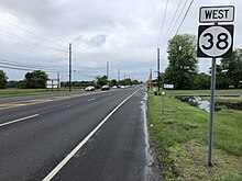
[1] The route then crosses the South Branch of the Rancocas Creek before entering Lumberton, where the road intersects with Mount Holly Bypass (CR 541).
It would then have run parallel to the current alignment of Route 38 through the Mount Holly area and then travel along the northern border of the Fort Dix Military Reservation to Jackson, Ocean County, where it would then follow the present alignment of I-195 to Wall Township.
[10][11] In 1969, it was estimated the Route 38 freeway between I-295 in Cherry Hill and I-195 in Jackson would cost $60 million and be completed by 1985.
[13] However, due to environmental concerns of the route passing through the Pine Barrens and financial troubles, the freeway was canceled by the end of the 1970s.