Land reclamation in Lower Manhattan
Since the passage of the Rivers and Harbors Act of 1899 all projects which extend into navigable waterways follow federal regulation and are overseen by the United States Army Corps of Engineers.
In December 2019, the New York City Council voted to approve the controversial $1.45 billion East Side Coastal Resiliency (ESCR) project,[17] involving the park's complete demolition and subsequent renovation.
[26][27] In 2021, the City of New York introduced the Financial District-Seaport (FidiSeaport) Resilience Plan for a 0.9-mile (1.4 km) stretch of what is seen as the most complicated and vulnerable reach of shoreline in Lower Manhattan.
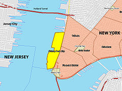
[10][28][29] Gansevoort Peninsula, located in what is now known as the Meatpacking District at the northern end of Greenwich Village, was originally a spit of land jutting into the Hudson River.
The market ultimately closed and the dock was converted to a sanitation facility that was used to load garbage barges headed for the Fresh Kills Landfill.
Canadian-American engineer T. Kennard Thomson first made an expansive proposal for "A Really Greater New York" in 1911, incorporating a lower Manhattan expansion into Governors Island (at that time undergoing land reclamation itself) as "New Manhattan", as well as other ambitious designs such as new Lower New York Bay islands, and filling in and creating new rivers.
Thomson made different versions of this idea through the years, forming a "Manhattan Extension" corporation in 1921 with support from prominent former judge and presidential candidate Alton B. Parker as well as the artist Walter Russell,[34][35][36][37] and continuing advocacy for the rest of his life.
[11] Chakrabarti and others pointed out challenges to the proposal, which include cost, the strict regulations surrounding building with landfill, and the potential environmental effects of the project.
[42][43] The proposal detailed creating 1,760 acres of reclaimed land, named New Mannahatta,[44][45] at the tip of Manhattan to provide housing and combat climate change.
In his New York Times opinion piece directed at Mayor Eric Adams, Barr argues that this extension, incorporating Governors Island, would address rising sea levels and provide 180,000 new homes for 247,000 people.
Barr emphasizes the need for large-scale initiatives to tackle New York’s storm surge, flooding, and housing affordability issues, citing Superstorm Sandy and Hurricane Ida as examples of the urgent need for action.
Financially, Barr suggests the high real estate values in New York could make the project feasible, using the difference between building costs and housing sales to fund the development.
Previous efforts, such as those by former mayor Bill de Blasio, have similarly aimed to protect Manhattan's shoreline from climate change.