New Philippines
The land consisted of the region north of the Medina and Nueces rivers, in what is now South-Central Texas; i.e., only the Central-Northern part of the current state overlaps with the territory of the New Philippines.
Informally, the border was set at the Arroyo Hondo, located between the French and the Spanish settlements, for the next 98 years.
As development increased in the 17th century, a new province was created on its east in 1687, namely, Nueva Extremadura, a very extensive territory at the time, now identified with the much smaller state of Coahuila, in Mexico.
[12][13] The name was first used by Antonio Margil in July 1716, during his participation in Domingo Ramón's expedition to prevent French expansion from Louisiana.
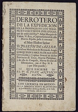
[17] In a report of his services to the Spanish government, Alarcón would go on to refer to himself as "governor and lieutenant captain general of the Province of the Texas and New Philippines.
"[18] Alarcón signed the foundation document of the San Antonio de Valero mission, dating it May 1, 1718, in his capacity as "General of the Provinces of the Kingdom of the New Philippines.
[f] Philip V having assented to his governorship of the territory, the Marqués de Aguayo on June 13, 1722, wrote back, thanking the king that the recovery (from the French) of the "New Kingdom of the Philippines, should have been entrusted to my feeble management.