New York State Route 18F
The southern terminus of the route is at an interchange with NY 104 and the Niagara Scenic Parkway just east of the village of Lewiston.
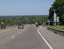
The northern terminus is at an intersection with NY 18 near Four Mile Creek State Park in Porter.
NY 18F cuts west on Oneida for two blocks before continuing northward out of the village on 2nd Street.
NY 18F continues on, passing through the western extent of Joseph Davis State Park south of the village of Youngstown in the town of Lewiston.
At the northern fringe of the community, NY 18F intersects the southern entrance to the Fort Niagara State Park.
The section of NY 18F from Center Street in Lewiston to the northern village line of Youngstown is maintained by Niagara County.
In December 1947, Lewiston petitioned the county to also assume maintenance of the portion of NY 18 within the village;[8] the request was eventually granted.
[4] On January 1, 1949, NY 18 was realigned to follow a more inland routing between the village of Lewiston and what is now Four Mile Creek State Park.