New York State Route 21
NY 21 was rerouted to follow its current alignment south of Hornell in the 1950s and truncated on its northern end to Williamson in 1980.
The route heads northward, paralleling the Western New York and Pennsylvania Railroad (WNYP) through a rural stretch of eastern Allegany County.
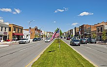
East of the county line, NY 21 leaves the vicinity of the expressway and passes through another undeveloped stretch to reach the city of Hornell, where it becomes West Main Street.
Not far to the north of this point is exit 34 of the Southern Tier Expressway, accessed by way of NY 36.
From Hornell, NY 21 heads northeast through progressively less developed areas as it winds its way across the hilly terrain of the Southern Tier.
For the next 15 miles (24 km), NY 21 serves only small, roadside hamlets, such as Fremont, Haskinville, and Loon Lake.
While NY 15 continues north from the village into Livingston County, NY 21 leaves Wayland on an east–west alignment, roughly paralleling the northern county line and a B&H Rail Corporation line as it runs through a valley surrounding the Cohocton River.
[3] While the river, its valley, and the rail line proceed south from North Cohocton, NY 21 turns to the northeast, ascending out of the valley and finally crossing the county line, at this point bordering Ontario County.
The two routes pass by 426 South Main Street, Benham House, and the city's former United States Post Office, all properties listed on the National Register of Historic Places, before splitting at the junction of Gibson and North Main streets.
The route heads northeast through farmland to Chapin, a small hamlet in the town of Hopewell, where it intersects the south end of NY 488 and turns to take on a more northerly course.
Not far to the north are the adjacent villages of Shortsville and Manchester, roughly separated by the Ontario Central Railroad.
Past the Thruway, NY 21 becomes rural in nature once more as it runs across rolling terrain to the Wayne County line.
[4] The route briefly overlaps NY 31 along East Main Street before crossing both the Erie Canal and the CSX Transportation-owned Rochester Subdivision on its way out of the village.
The trail began in the vicinity of Geneva and went west to Canandaigua on a path now occupied by US 20 and NY 5.
It continued north from Canandaigua, passing through the village of Palmyra and the hamlet of Marion before reaching the Lake Ontario shoreline at Pultneyville.
The highway fell into disrepair over the years, leading travelers to conceive ways to avoid paying toll.
NY 21 was also realigned at this time to follow its modern routing on the bypass and South Main Street.
[20][21] The segment of Bristol Street vacated by NY 21 between the Western Bypass and the Canandaigua city line was maintained by the New York State Department of Transportation (NYSDOT) as unsigned NY 943A until September 1, 1996, when maintenance of the road was turned over to the town of Canandaigua.