New York State Route 227
When NY 227 was assigned as part of the 1930 renumbering of state highways in New York, it extended from just east of Watkins Glen to Perry City.
The route bends northward, passing the eastern extremities of Finger Lakes National Forest before turning eastward into the hamlet of Reynoldsville.
After leaving the hamlet, the route keeps its gradual northeastern progression, running parallel with the nearby Updyke Road, which forks off toward NY 228.
It finally heads due east into the hamlet of Perry City, where it passes some houses ahead of the northern terminus of NY 228.
After 1 mile (1.6 km), NY 227 turns northeastward, leaving the border and completely entering Tompkins County in the town of Ulysses.
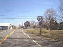
NY 227 continues its northeastern progression into the village of Trumansburg, initially passing the local golf course and intersecting with the eastern terminus of CR 149 (Searsburg Road).
The area around the road becomes primarily residential, a trend that follows the route to its northern end at a junction with NY 96 (West Main Street) in downtown Trumansburg.