New York State Route 28N
The byway marks the path Roosevelt took in 1901 to reach North Creek from Mount Marcy after learning that President William McKinley had been assassinated.
[3] The highway, concurrent with Route 30, heads north through the hamlet nestled at the base of Blue Mountain, one of the highest peaks in Adirondack Park standing, 3,795 feet (1,157 m) above sea level.
The highway crosses Boreas Creek, which flows southwest in the park,[14] and eventually passes a series of lakes.
[17] The road, after leaving Minerva, passes Moxham Mountain, a 2,200-foot (670 m) peak,[17] and eventually crosses the Hudson River.
Traffic volumes are reduced to 1,231 vehicles per day from the end of the Route 30 overlap to the intersection with Blue Ridge Road (CR 84).
Minerva was mainly limited to the vicinity of the old highway, but as more people settled along the road, the town began to grow.
The iron ore industry contributed to population growth via 30-mile (48 km) to 40-mile (64 km) roads to Lake Champlain that were meant for hauling ore.[20] The highway from Warren County to Long Lake became part of the state system as early as 1909.
[22] After 1845, Newcomb's iron ore industry began to decline and the town evolved into somewhat of a sportsmen's resort.
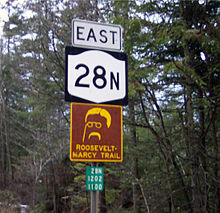
[23] The 40-mile (64 km) section of 28N between Long Lake and North Creek is a scenic byway named the Roosevelt–Marcy Trail.
[24] This was the route traveled on September 10, 1901 by Theodore Roosevelt, then Vice President of the United States.
From the train station there, he traveled to Buffalo, where, after McKinley died, he was sworn in as president on September 14.
[26] In 1924, the portion of Route 25 from Long Lake to North Creek was designated as part of the signed NY 10.
[29] The New York State Department of Transportation has scheduled for NY 28N to undergo construction in spring 2013, to rehabilitate the bridge over the Upper Hudson River Railroad.
[30] New York State Department of Transportation has also planned for NY 28N's bridge over Stillwater Brook in Minerva to be replaced with a stronger structure.