New York State Route 28
NY 28 was originally assigned in 1924, to an alignment extending from Colliersville in the south to Utica in the north via Ilion.
The route was extended south to Kingston and north to Warrensburg as part of the 1930 renumbering of state highways in New York.
Other than minor realignments in Kingston, Oneonta, Herkimer, and Oneida County, NY 28 has remained the same to this day.
The route heads north, then northwest on Colonel Chandler Drive, a four-lane freeway.
Although Colonel Chandler Drive is built to Interstate Highway standards, it has no intermediary interchanges.
After crossing over the Esopus Creek into Ulster, I-587 terminates at a roundabout that links I-587 and NY 28 to the New York State Thruway (I-87) at exit 19.
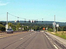
[3] West of I-87, the route becomes a four-lane undivided road and crosses the Blue Line of Catskill Park and becomes the Onteora Trail.
It proceeds along the reservoir to its western end in the town of Olive community of Boiceville, where NY 28A reconnects to the route.
[3] Past Phoenicia, the surrounding slopes become steeper as the road and creek curve around Panther Mountain, one of the Catskill High Peaks, to the south.
At Allaben, the Shandaken Tunnel crosses under the road, bringing water from Schoharie Reservoir into the creek.
The northern terminus of NY 42's southern segment marks the small hamlet of Big Indian, after which Esopus Creek crosses for the last time, turning south to its source at Winnisook Lake.
The road begins a sustained climb over the next two miles paralleling an Esopus tributary, Birch Creek, up to Pine Hill.
At the road to Belleayre Ski Center, in Highmount, the last junction before it leaves the Catskill Park and enters Delaware County, it is for the first time signed as a north–south route.
[3] Once in Otsego County, it traverses an s-curve before veering to the east to follow the southern bank of the Susquehanna River through the town of Oneonta.
The route initially connects to the city of Oneonta, which is located across the river from NY 28, via Main Street.
[3] Back in the town of Oneonta, the overlap between NY 28 and I-88 continues along the northern bank of the Susquehanna toward the hamlet of Emmons, where the expressway meets County Route 47 (CR 47) at exit 16.
The overlap ends at exit 17 in Milford; however, NY 28 remains in close proximity to the Susquehanna River, which turns northward at the interchange.
[3] The highway continues northward along the banks of the Susquehanna to the village of Cooperstown, home to the National Baseball Hall of Fame.
Two blocks from the business district of the village, it intersects NY 80, which occupies Chestnut Street north of this point.
At that time it followed modern NY 28 west from Kingston up to the Delaware County hamlet of Andes.
[8] It continued east from there using part of present-day CR 52 to eventually connect with and follow the route of current NY 199.
NY 28 was designated in 1924, by the New York State Department of Transportation from Colliersville (near Oneonta) north to Utica.
[2] At the time, NY 28 began at then-NY 9 in Colliersville and headed north on its current alignment to Cooperstown.
Here, the highway turned westward, using a small portion of its current alignment and the present-day NY 5S corridor to connect to Utica by way of Ilion.
[10][11][12] In the 1930 renumbering, NY 28 was extended south from Colliersville to Kingston largely by way of its current alignment along the Ulster and Delaware Turnpike.
[13] NY 28 was rerouted slightly c. 1940 to enter Barneveld via an extension of Trenton Falls Road and Mappa Avenue.
[16][17] Within Kingston, NY 28 initially began at the intersection of Broadway and East Chester Street, which was part of US 9W at the time.
During May 2000, troopers Kelly and Poorman were killed on this stretch of NY 28, when their police cruiser was struck by a tractor-trailer.