Niha, Zahlé
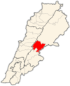
[2] Niha is bordered to the west by the high rising mountains of Mount Lebanon and the peak of Mount Sannine, to the north by the village of Tamnine, to the south by the villages of Nabi Ayla (Arabic: نبي أيلا) and Forzol (Arabic: ألفرزل), and to the east by Ablah and the fertile plains of the Bekaa.
Red soil mixed with limestone make the ground fertile for agriculture which dominates the economy of the village (and that of the Bekaa Valley).
The village as well as the rest of the Bekaa produce the bulk of the fruits in Lebanon and export significant volumes to the Arab countries.
A new wastewater treatment plant was planned to be established in 2009 with the assistance of USAID for the villages of Niha, Ablah and Nabi Ayla.
[6] The 19th century witnessed the migration of Christian families from Mount Lebanon (notably Keserwan and Matn regions) to the Bekaa.
As one enters the gate at the edge of the village into the archeological park that is maintained by the Department of Antiquities, the Lower Small Temple appears first and directly ahead to the right of the creek.
In the remains of this temple, archaeologists discovered a stone with an inscription mentioning a “female virgin prophet” named Hochmea.
The entrance of the temple faces east; it is built over a large podium and accessed through a three-part stairway leading to a portico with four columns with Corinthian-style capitals.
To the right side of the lintel, a carved relief represents a winged naked boy holding a palm leaf in his left hand.
The inside of the Great Temple consists of two parts: the cella, where the people used to gather, and the elevated adytum, which was accessed by a stairway.
The doorway leading to the crypt is decorated with a carved relief representing a priest pouring holy water over an altar.
Built on a podium facing toward the east, the Upper Great Temple is composed of a portico with four columns, leading to a cella, and then to an elevated adytum.
It is common in Lebanon that all voters return to their claimed village of ancestry for suffrage regardless of their place of residence in the country.
The population is made of several family surnames, most notably Maalouf (معلوف), Ayoub (أيوب), Rmeily (رميلي), Fakhry (فخري), Hrawi (هراوي), Najjar (نجار), Kerbaje (كرباج), Rabbah (رباح), Abu Deyye (ابو ديه), Harb (حرب), Ghanem (غانم), Ziadeh (زيادة), Allam (علام), and Sharafeddine (شرف ألدين).
The Church of the Prophet Elias (Arabic: مار إلياس) was built c. 1880 and serves the villagers of the Greek Orthodox faith.
Until the 1960s, the population dressed in traditional Lebanese costumes, notably the male sherwal garment characterized by baggy pants and headdresses, or the gambaz, a long gown worn by both sexes.
The village produce includes grapes, apples, cherries, almonds, that are then transported to Zahlé, Beirut or exported to Arab countries.
Albeit modern amenities such as telephones are now available in the village, the residents continue to live by century-old practices such as storing food supplies for the winter season.
During the summer, villagers are seen busy preparing kishk (Arabic: كشك) a specialty powdery dish made from cracked wheat and yogurt.
The village is home to a secondary education school ( ثانوية نيحا) and boasts a high concentration of college graduates including medical doctors, engineers, scientists and teachers.