Nilometer
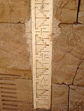
[1] There were three main types of nilometers, calibrated in Egyptian cubits: (1) a vertical column, (2) a corridor stairway of steps leading down to the Nile, and (3) a deep well with a culvert.
When the waters receded, around September or October, they left behind a rich alluvial deposit of exceptionally fertile black silt over the croplands.
This is where the nilometer came into play, with priests monitoring the day-to-day level of the river and announcing the awaited arrival of the summer flood.
[5] The restriction on who may access these structures ensured both accountability in proper readings and political control for the religious communities and ruling classes.
This nilometer visible today dates as far back as AD 861, when the Abbasid caliph al-Mutawakkil ordered its construction,[6] overseen by the astronomer al-Farghani.
ʿAdī, who was in charge of collecting the land tax (kharaj) in Egypt for the Umayyad caliph Sulaymān ibn ʿAbd al-Malik.
[8] This location was also particularly important, since for much of Egyptian history, Elephantine marked Egypt's southern border and was therefore the first place where the onset of the annual flood was detected.
The most elaborate design involved a canal or culvert that led from the riverbank – often running for a considerable distance – and then fed a well, tank, or cistern.
A particularly fine example, with a deep, cylindrical well and a culvert opening in the surrounding wall, can be seen at the Temple of Kom Ombo, to the north of Aswan.
While the Aswan High Dam's impact on Egypt and its agriculture has been controversial for other, more complex reasons, it has also had the additional effect of rendering the nilometer obsolete.
[9]: 296 Yaqut al-Hamawi, writing in the 12th–13th centuries, claims that in the beginning of year 247 AH (March 861), during Yazid ibn Abd Allah al-Turki's governorship of Egypt, the Abbasid caliph al-Mutawakkil had the 'new' nilometer constructed and ordered that the privilege of measuring the river 'be taken away from the Christians.'
[10] K. A. C. Creswell states that the main inscription of the nilometer was probably tampered with by Ibn Tulun, saying "there can be little doubt that it was he who removed the name of the Abbasid Khalif."
[13] In 1937, efforts to drain and excavate the nilometer were begun by Kamil Bey Ghalib, the Under-Secretary of State for Public Works, employing a new method used by Rothpletz and Lienhard.