Noordhollandsch Kanaal
It starts at Den Helder in the north, and then goes through Alkmaar and Purmerend, and ends opposite the IJ at Amsterdam.
However, from its construction till about 1880 it had a totally different character, because it was a canal meant for ocean-going ships.
Ships would sail from the Americas or East-Asia, and then be towed along the canal from Den Helder to Amsterdam.
The king centered part of his efforts on improving, extending and updating roads and waterways in the Netherlands.
A few years after the canal had been opened, an overview of the number of ships arriving in Amsterdam from 1817 to 1828 was published.
[2] It shows that the first years after regaining independence probably gave rise to high expectations for the recovery of Amsterdam as a major harbor.
Legend has it that King William I used a pencil to indicate that a canal should be dug from Amsterdam straight to the west.
His reasons are supposed to have been: The government then decided to construct a canal from Amsterdam to Nieuwediep, and ordered Jan Blanken to make a design.
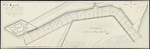
On the south shore, a dyke would have to be made in the IJ from Het Blauwhoofd in the northwest of the city, to Zeeburg in the east.
Amsterdam was also afraid that shipbuilders would move to Den Helder, and asked for a ban on building new, or expanding the existing, shipyards at Nieuwediep.
After the Goudriaan plan for a canal that bypassed Pampus got underway, Amsterdam finally gave in.
Instead a new route was dug west of it, from the Schoorlse Zeedijk at Zijpersluis to the Zijpe lock just north of 't Zand.
The hamlet of Zijpersluis has the ancient Jacob Claesse lock, which cuts off the Groote Sloot from the Noordhollandsch Kanaal.
[16] However, when the new route was dug, Zijpersluis got a flood gate which could be closed with beams, the so-called Doorvaartsluis, or simply Doorvaart (passage), which was later removed.
These names are also practical homonyms of the nearby place Zijpersluis, which has the Jacob Claesse lock and had a flood gate.
At the time this was not a lock, but only a flood gate that let navy ships in and out of the wet dock when the tide was level with the sea.
[26] There are now five raft bridges, all of them north of the city center of Alkmaar: In August 1817 the commercial lock of Den Helder first became operational.
They also made a trip on a large boat that was towed along the new canal on the inside of the new Koegras dyke till they reached 't Zand, from whence they returned home.
[27] On 13 December 1824 the frigate HNLMS Bellona of 44 guns passed the Willem I Lock and entered the canal.
She passed Spijkerboor, and reached West-Graftdijk at 5 pm, where the frigate moored due to the extremely bad sight.
On 15 December fierce winds delayed Bellona, but by the end of the day she had reached the Zeglis at Alkmaar.
At 5 PM she moored in the Koopvaarders Binnenhaven (Commercial inner harbor) of Nieuwediep, completing the first trip on the canal.
[29] On 29 December 1824 Christina Bernardina arrived in Amsterdam as first major commercial vessel using the canal.
[50] By July 1831 the dykes around the two wet docks of Amsterdam (Westerdok and Oosterdok) provided shelter to the ships using them.
Oosterdok had also been brought to sufficient depth for sea-going ships to reach the Entrepotdok, where goods could be stored for transit without having to pay import taxes.
It suggests that on the return journey many empty, lightly loaded, and small enough ships, sailed the Zuiderzee, even if they had come in through the canal.
[60] However, this lock had an alternative route through the navy wet dock, albeit with its own limits and extra delays.
[60] On 27 July 1856 the government appointed a commission to investigate how the Noordhollandsch Canal could be made completely suitable to the needs of commerce and navy.
[23] In July 1866 Gebroeders Goedkoop started Schroef-Stoom Sleepdienst Noord Holland, that towed ships along the canal using propeller driven tugboats.
[68] Completed in 1876, the North Sea Canal made the Noordhollandsch Kanaal largely obsolete.