Ocmulgee River
[1] Since the construction of the Lloyd Shoals Dam in the early 20th century, these rivers join as arms of the Jackson Lake reservoir.
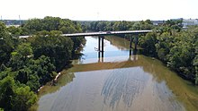
[1] The Ocmulgee River flows from the dam southeast past Macon, which was founded on the Fall Line.
It joins the Oconee from the northwest (241 miles downstream from Jackson Lake) to form the Altamaha near Lumber City.
[2] According to a Georgia Department of Natural Resources report, "many of these species are well-established and are detrimental to native fish populations.
[2] Archeological evidence shows that Native Americans first inhabited the Ocmulgee basin about 10,000 to 15,000 years ago (see settlement of the Americas).
[1] Scraping tools and flint spearpoints from nomadic Paleoindians hunters have been discovered in the Ocmulgee floodplain.
[1] There is evidence that the Mississippian culture reached the Ocmulgee basin by 900 CE; according to the New Georgia Encyclopedia, "on the Macon plateau and in the nearby Ocmulgee bottomlands, stretches of farmsteads and gardens constructed around elaborate ceremonial mounds are the most prominent evidence of this early Mississippian influence.
In 1715, the English recorded ten towns among the "Ochese Creek Indians" (which the Spanish called "Uchese"), with a population of 2,406.
Several of the Hitchiti-speaking towns were located to the southern part of the Ochese Creek cluster, including Ocmulgee, Hitchiti, and Osuchi.
That same year United States Army established Fort Benjamin Hawkins overlooking the Ocmulgee Fields.
During the 19th century, the river provided the principal water navigation route for Macon, allowing the development of the cotton industry in the surrounding region.