Onondaga County, New York
The federally recognized Onondaga Nation has a 9.3 square miles (24 km2) reservation within the county, on which they have self-government.
The Onondaga were among four Iroquois tribes that allied with the British against the American colonists, as they hoped to end their encroachment.
At the time Onondaga County was organized, it was divided into eleven towns: Homer, Pompey, Manlius, Lysander, Marcellus, Ulysses, Milton, Scipio, Ovid, Aurelius and Romulus.
[3] Central New York developed rapidly after the New Military Tract provided land in lieu of payment to Revolutionary War veterans.
Over time, as early clearing and farming eroded hillside soil, valley lands were more fertile and highly prized for agriculture as well as for water power, which was the origin of many communities.
An early settler of 1823 was James Hutchinson Woodworth, a native of Washington County, NY.
He helped clear land for his family's farm in this region before he moved to Chicago where he became Mayor.
The completion of the Erie Canal across New York state in 1825 accelerated trade, development and migration.
The city of Syracuse, New York developed relatively late, due to its marshy situation.
The population of these rural towns was greatest in the late nineteenth century, when more people cultivated land and farms were relatively small, supporting large households.
Onondaga County highlands now are more heavily reforested, with public parks and preserves providing recreation.
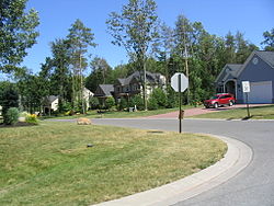
Elsewhere, scattered commuter houses appeared, generally on fairly large parcels.
[5] Onondaga County is in the central portion of New York State, west of Albany and Utica, east of Rochester and northeast of Ithaca.
The second highest point in Onondaga County is at 2019 feet elevation and on the summit of Fellows Hill which is located in Morgan Hill State Forest near Fabius and Apulia south of state route 80.
US 20 extends east and west across the county, traversing dramatic hill-and-valley terrain.
Between the lake plain and Appalachian highlands is a zone noted for drumlins, smaller, scattered hills formed as mounds of debris left by the last glacier.
Tully is geologically noted for the terminal moraine deposited there by the glacier, filling the deep Tully Valley, which might have been another Finger Lake had the moraine been left closer to Syracuse, impounding water.
The Appalachian hills have several ski areas, waterfalls and historic villages as well as large parks and forest preserves.
Upstate Medical University is the largest producer of jobs in the region with a direct workforce of 10,959 employees.
[20] Historically, Onondaga County was a Republican stronghold, like most of Central New York.
From 1856 to 1988, the GOP carried the county in all but one presidential election, Lyndon B. Johnson's landslide in 1964.
Onondaga is entirely located within New York's 22nd Congressional District, represented by Democrat John Mannion.