Operation Gearbox II
From 9 to 13 September, relays of destroyers were detached from PQ 18 to refuel before the convoy passed Bjørnøya (Bear Island), into range of Luftwaffe bombers and torpedo-bombers based in north Norway.
Drift mines were linked to the shore by overhead cable tracks or rails and coal dumped over the winter was collected by ship after the summer thaw.
[1] The British Government Code and Cypher School (GC&CS) based at Bletchley Park housed a small industry of code-breakers and traffic analysts.
Combined with their knowledge of Luftwaffe procedures, the computers could give fairly accurate details of German reconnaissance sorties and sometimes predicted attacks twenty minutes before they were detected by radar.
[4] From 25 July to 9 August 1940, the cruiser Admiral Hipper sailed from Trondheim to search the area from Tromsø to Bear Island (Bjørnøya) and Svalbard, to intercept British ships returning from Petsamo but found only a Finnish freighter.
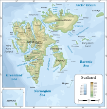
Vian was sent to look at the west coast of Spitsbergen, the main island of Svalbard, which was mostly ice-free and 450 mi (720 km) from northern Norway, to assess its potential as a base.
Norwegian and Russian civilians were to be evacuated using the same two cruisers, with five destroyer escorts, an oiler and RMS Empress of Canada, a troop transport carrying 645 men, mainly Canadian infantry.
[8] Normal business was kept up at the Barentsburg wireless station by the Norwegian Military Governor Designate, Lieutenant Ragnvald Tamber; three colliers sent from the mainland were hijacked along with a seal ship MS Selis, the ice-breaker SS Isbjørn, a tug and two fishing boats.
The He 111s and Ju 88s of Wekusta 5 ranged over the Arctic Ocean, past Spitsbergen and Jan Mayen, towards Greenland; the experience gained made the unit capable of transporting and supplying manned and automatic weather stations.
[13] After the wireless on Spitsbergen had mysteriously ceased transmission in early September, German reconnaissance flights from Banak discovered the Canadian demolitions, burning coal dumps and saw one man, a conscientious objector who had refused to leave, waving to them.
Dr Erich Etienne, a former Polar explorer, commanded an operation to install a manned station on the islands but with winter imminent, time was short.
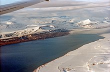
Advent Bay (Adventfjorden) was chosen for its broad valley, making a safer approach for aircraft; its subsoil of alluvial gravel was acceptable for a landing ground.
[17] On 2 May 1942, the apparatus for an automatic weather station, a thermometer, barometer, transmitter and batteries arrived at Banak, in a box nicknamed Kröte (toad) by the aircrew.
Major Amherst Whatman, a Polar explorer and signals specialist, repaired and operated the wireless set but it broke down on the journey to Iceland and was not reliable for the rest of the voyage.
The local swine herd has been slaughtered during Gauntlet and the arctic cold had preserved the meat; wild duck could be plundered for eggs and an infirmary was also found, still stocked with dressings for the wounded.
Lieutenant Ove Roll Lund sent parties south to Sveagruva (Swedish Mine) in Van Mijenfjord and to reconnoitre the Germans in Advent Bay around the airstrip at Bansö.
In the midnight sun (20 April – 22 August) as mid-summer approached, the ice further west, near the Allied positions, cleared faster than at the German (eastern) end of the fiord.
[25] The remainder of Fritham Force at Barentsburg was consolidated by the reinforcements of Operation Gearbox and its sequels, a weather station was set up and wireless contact with the Admiralty regained.
Many survivors, including about forty men seen on the flight to north Russia, were rescued and ships reported sheltering at Novaya Zemlya were escorted safely to port.
At the beginning of August, Ullring took a party of nine men north along the coast and to Kongsfjorden (Kingsfjord) in the cutter to look for another German weather station but found only a footprint.
Glen and some of the German equipment were picked up from Barentsburg and flown back to Sullom Voe though thick fog but with breaks in the high cloud enabling the crew to take astro shots; a new Air Position Indicator was also used.
[30] After the calamity of PQ 17, The chief of RAF Coastal Command, Philip Joubert, revived a proposal to base a force of torpedo-bombers in north Russia, which took place as Operation Orator.
Eclipse and four more destroyers arrived on 17 September, with 130 long tons (130 t) of supplies and a party of Norwegian troops (Lieutenant-Colonel Albert Tornerud, also the successor of Ullring as Military Governor).
Glen began to prepare the local aspects of Gearbox II and Ullring relinquished command to Tornerud; Whatman remained the British Liaison Officer and stayed over the winter of 1942–1943, before being relieved.
[35] After the war, the surviving crew members found that a Ju 88 of 1 Staffel, Fernaufklärungsgeschwader 22 (Long-Range Reconnaissance Group 22) from Banak in north Norway, had crashed off Tamsöy Island that day, attributed to an engagement with a "Russian flying boat".
[38] On 7 June 1943, the cruisers Cumberland, Bermuda and two destroyers sailed from Iceland covered by the Home Fleet, landing reinforcements and supplies for Gearbox II on 10 July.
[39] Nussbaum, another Kriegsmarine meteorological party, commanded by Dr Franz Nusser, departed Norway in U-377 to return to Svalbard and re-occupy the Knospe base at Signehamna that had spent the winter of 1941–1942 gathering weather data.
[41] On 7 September, supported by a shore bombardment, the only occasion that Tirpitz fired its main battery horizontally in anger, a battalion of infantry landed and captured the installations at Barentsburg; after destroying the coal depots and other facilities, the German force withdrew.
The exceptionally large number of destroyer escorts was maintained by detaching relays (9–13 September) to refuel from the two fleet oilers anchored in Van Mijenfjorden (Lowe Sound) in southern Spitsbergen.
In 1956, the US naval official historian Samuel Eliot Morison called it "overstuffed"; the attack had been magnified by German propaganda, despite being an enterprise needing little more than a destroyer.