Ordos Plateau
After reversing course back towards the east, it begins the massive Ordos Loop by turning northwards at Zhongning County in Ningxia.
It runs northwards about 640 kilometers (398 mi), leaving the Loess Plateau—whose eroded silt produces the river's yellow color—for the Ordos proper before turning east in Inner Mongolia.
The eastern side of the loop runs about 600 kilometers (373 mi), re-entering the Loess Plateau before reaching its confluence with the Wei River at Tongguan in Shaanxi and again turning sharply eastward.
At the southwest corner near where the Yellow River emerges from the Tibetan Plateau is Lanzhou, the westernmost large city in north China and the capital of Gansu.
This corridor and the Wei River valley became the main silk road route from China proper to the Tarim basin and westward.
The river leaves the northern tip of Ningxia south of Wuhai, flows through desert and enters a large irrigated area at Dengkou.
One can go upstream on the Wei with the Qin Mountains with Mount Hua on the south past Weinan to Xi'an, a former capital of China and now a large city.
Rulers based in the Wei valley had an advantage since the mountains to the east made a natural fortification and war horses were readily available from the northern grasslands.
By the Tang dynasty the economic center of China had shifted to the Yangzi valley and the Wei region became partly dependent of food imported up the Grand Canal.
It is associated with about 327 burials, with recent maternal genetic evidence showing that they were related to the remains from Yinniugou, as well as modern populations like Daurs and Evenks.
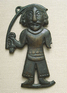
These finds are important as they are associated with the development of snake pattern designs on the decoration of weapon and animal-depicting artifacts which later would become a characteristic style of the Ordos.
[12] The skeletal remains at Taohongbala (桃紅巴拉) tomb dated to between the 7th and 6th centuries BC are generally identified as belonging to the Xiongnu bronze culture and show strong Mongoloid features.
[13][14] A similar type of burial at Hulusitai around Bayannur, uncovered in 1979 and dated to between the 5th and 4th centuries BCE, is considered the only Xiongnu site along the northern slope of Yinshan.
[15] Further excavation in 1983 at Guoxianyaozi uncovered a total of 31 burials dated to the 6th to 5th century BC revealing strong north Mongoloid features.
These generally decreased towards the south, and skeletal remains of east and north Mongoloid type can be seen from finds in Maoqinggou and Yinniugou dated to around the 7th century BC, amounting to a total of 117 burials.
[23] Because the people represented in archaeological finds tend to display Europoid features, also earlier noted by Otto J. Maenchen-Helfen,[24] Lededynsky suggests the Ordos to be of Scythian affinity.
Their former territory is now located just north of the Great Wall of China, and on the south bank of the northernmost hook of the Yellow River.
The western neighbours of Ordos may have been identical with the Yuezhi who, after being vanquished by the Xiongnu, migrated to southern Asia to form the Kushan Empire.
They were also culturally related to another nomadic tribe to the east, the Eastern Hu (東胡; Donghu), who shared a similar "art of the steppes," but appear to have been Mongoloids.
In Chinese accounts, the Xiongnu first appear at Ordos in the Yizhoushu and Shanhaijing during the Warring States period before it was occupied by Qin and Zhao.