Pagus Lomacensis
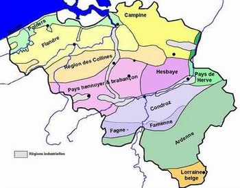
In modern terms Lomme stretched from north to south in what is now central Wallonia in French-speaking Belgium.
It also stretched into what is now Walloon Brabant in the north, the Belgian Province of Hainaut in the west, and to the south, into what is now France.
After a possibly falsified document of 660, more surviving records start in the second half of the 8th century, in the time when the Carolingians were taking charge of the Frankish realm.
Around 800, the Bishop of Liège addressed himself to the Christian community of the time, and named only Condroz, Lomme, Hasbania, and the Ardennes, with no mention of the Maas valley or Texandria further north.
[4] The northern part of the Roman Civitas Tungrorum probably no longer had clear boundaries, and missionary work to extend the Christian diocese was on-going at this time.
In the west and south of these two parts of the Lommegau, were forested and hilly areas which help define a natural boundary between France and Belgium.
During the evolutions of the Frankish kingdoms, the southern frontier also remained an important one, defining the boundary between Neustria and Austrasia in Merovingian times.