Palmdale, California
[10] Populated by different groups for an estimated 11,000 years, the Antelope Valley was a trade route for nomadic pre-Americans traveling from what is now Arizona and New Mexico to California's coast.
The opening of California to overland travel through the forbearing desert was due to Captain Juan Bautista de Anza and Father Francisco Garces, a Spanish priest.
[13] "Palmenthal", the first permanent settlement within the limits of Palmdale, was established as a village on April 20, 1886, by westward Lutheran travelers from the American Midwest, mostly of German and Swiss descent.
By the 1890s (soon after the last of the indigenous antelopes, which the valley was named after, had been hunted to extinction, farming families continued to migrate to Palmenthal and nearby Harold to grow grain and fruit.
Palmdale's modern development commenced in the mid-1800s due to the influence of the gold rush, cattle ranching, the introduction of stagecoaches, and the establishment of the Southern Pacific Railroad line in 1876.
[20] In 1921, the first major motor vehicle link between Palmdale and Los Angeles was completed, Mint Canyon/Lancaster Road, later designated U.S. Route 6.
Completion of this road caused the local agricultural industry to flourish and was the first major step towards defining the metropolis that exists today.
[21] In 1924, the Little Rock Dam and the Harold Reservoir, present day Lake Palmdale, were constructed to assist the agricultural industry and have enough water to serve the growing communities.
[21] Agriculture continued to be the foremost industry for Palmdale and its northern neighbor Lancaster until the outbreak of World War II.
[22] They also bought Palmdale Airport in 1952 and established an aerospace development and testing facility called United States Air Force Plant 42.
[16] In August 1956, an unpiloted out-of-control Navy drone flew over Palmdale while Air Force Interceptor aircraft tried to shoot it down with unguided rockets.
However, the United States Air Force desired to put construction of this new facility on hold until the existing airport reached its commercial capacity.
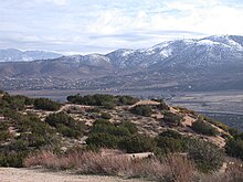
Palmdale is part of a twin-city complex with its northern neighbor Lancaster and together they are the principal cities within the Antelope Valley region and California's High Desert.
38.1% of Palmdale residents are of Mexican ancestry; 6.2% Salvadoran; and 2.4% of Guatemalan heritage and 0.79% Honduran, 0.76% Puerto Rican, 0.69% Nicaraguan, 0.50% Cuban, 0.47% Colombian and Argentinian 0.34%.
The most common ancestries are German 5.2%, Irish 4.1%, English 2.9%, Italian 2.7%, French 1.1%, Polish 1.0%, Norwegian 0.7%, Scottish 0.6%, Dutch 0.6%, Russian 0.6%, Swedish 0.5%, Belizean 0.4%, Armenian 0.4% and Danish, Welsh and Greek 0.3%.
These are special zoning areas within the city that are given various state and federal tax breaks and municipal grant incentives to relocate their business there.
The local governments of the Antelope Valley seek to diversify their economies and not just depend on the aerospace industry as it is known for having "feast or famine" seasons.
Palmdale refers to itself with the nickname the "aerospace capital of the United States", and has been the site of research, development, final assembly, flight testing and/or servicing/modifications of the Space Shuttle, B-1 Lancer, X-15, B-2 Spirit, B-21 Raider, F-117 Nighthawk, F-22 Raptor, F-35 Lightning II, SR-71 Blackbird, Lockheed L-1011 Tristar, and many other aircraft that have been used in the United States Air Force, NASA and air forces and airlines around the world.
NASA's SOFIA program relocated its operation to this hangar at Site 9 from Edwards Air Force Base.
A number of world class corporations and manufacturing firms have made Palmdale home, helping to diversify the local economy.
Delta Scientific, a world leader in high strength vehicle barrier systems, supplying protection for many federal, state and local buildings, and a prime supplier to the military and US State Department for embassies and other installations worldwide, and US Pole, a major manufacturer of street lighting poles, are major anchor tenants in the Fairway Business Park.
[51] Final assembly work has already occurred in hangar space the company leased in Palmdale from Los Angeles World Airports.
[53] The Antelope Valley Mall is the retail shopping destination in the region, with a variety of dining choices on its restaurant row.
This allowed Palmdale to draft a city charter and constitution, enabling it to make more decisions at the local level without interference or rules from the state government.
[64] City officials have formed the Palmdale Airport Authority, as they pursue regional air service from a joint use facility at USAF Plant 42.
The city successfully licensed and sold permits for a hybrid natural gas and steam turbine power facility and its operator is awaiting state approval of amendments to begin construction.
[80] The LA/Palmdale Regional Airport/Air Force Plant 42 (PMD) has two runways, each over 2.25 miles (3.62 km) in length, although there is currently no commercial airline service at the airport.
From the oversized runway and the massive hangar located at Air Force Plant 42 Site 9, NASA conducts worldwide environmental research with its ER-2 (a U-2 variant) and cutting edge deep space imaging with the 747-based SOFIA infrared telescope.
The Antelope Valley Freeway (SR 14) is the major north–south highway connecting Palmdale to Los Angeles and Mojave.
The city is essentially on a perfect grid, and the traffic signals are coordinated by a central processing facility at the Civic Center.