Pennine Way
The trail stretches for 268 miles (431 km)[1] from Edale, in the northern Derbyshire Peak District, north through the Yorkshire Dales and Northumberland National Park and ends at Kirk Yetholm, just inside the Scottish border.
Stephenson proposed the concept in an article for the Daily Herald in 1935, and lobbied Parliament for the creation of an official trail.
[8] The popularity of the walk has resulted in substantial erosion to the terrain in places,[9] and steps have been taken to recover its condition, including diverting sections of the path onto firmer ground, and laying flagstones or duckboards in softer areas.
[10] Accommodation is available at youth hostels, camp sites, bed-and-breakfasts and pubs, but is limited on upland stretches, so when planning the walk one must sometimes choose between a long day (between two places offering on-route accommodation) or two shorter days involving an evening descent off-route (to a nearby village or farm) with a morning re-ascent.
This makes it easy to sample a short section of the trail, or to split the Pennine Way across several holidays or long weekends.
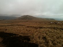
It then turns north to follow the western edge of the plateau past Kinder Downfall, crosses the Snake Pass road (A57) and climbs Bleaklow.
[12] From Crowden the Pennine Way climbs a side valley past Laddow Rocks to the summit of Black Hill on the border of Yorkshire.
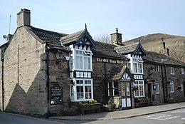
From the monument it descends steeply to the valley of the River Calder, which it crosses about 1 mile (1.6 km) west of the town of Hebden Bridge, the largest settlement near the route.
There then follows gentler country, including a short section of the towpath of the Leeds and Liverpool Canal at East Marton, to reach the village of Gargrave in Airedale, on the busy A65.
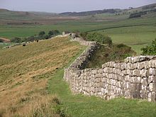
It passes the eastern end of Ling Gill and climbs Cam Fell, where it follows the line of a Roman road, shared with the Dales Way.
The trail then passes Dodd Fell Hill and follows a ridge between Widdale and Sleddale, before descending into Wensleydale at Gayle and the adjoining town of Hawes.
The main route heads directly north across the moors, crossing God's Bridge and passing beneath the A66 road in a tunnel.
The trail then ascends the gently rising side valley of Maize Beck to reach High Cup Gill, one of the most photographed areas on the Pennine Way.
Here, walkers can face tricky conditions in bad weather as a result of the Helm Wind which sweeps down the south-west slope of the escarpment.
[23] The trail continues down the valley of the South Tyne, past the Roman fort of Whitley Castle, to Slaggyford and Knarsdale.
The trail eventually reaches Redesdale at Blakehopeburnhaugh and Cottonshopeburnfoot, two neighbouring hamlets which compete for the longest name in England.
[25] The last stage of the Pennine Way, across the Cheviot Hills from Byrness to Kirk Yetholm, is 27 miles (43 km) long, with no habitation en route.
[33] The Pennine Way has attracted a number of writers over the years, including Tom Stephenson, who wrote the first official guidebook.
A popular guide was written and illustrated by the writer Alfred Wainwright, whose offer to buy a half-pint of beer for anyone who finished the Pennine Way is estimated to have cost him up to £15,000 by his death in 1991.
Barry Pilton's book One Man and His Bog gives a more lighthearted and personal account of completing the Pennine Way, with a foreword by Mike Harding.