Perisher Ski Resort
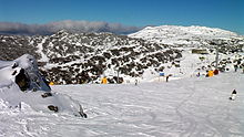
[1] Located in the Australian Snowy Mountains, the resort is an amalgamation of four villages (Perisher Valley, Smiggin Holes, Guthega, and Blue Cow) and their associated ski fields, covering approximately 12 square kilometres (5 sq mi), with the base elevation at 1,720 metres (5,640 ft) AHD, and the summit elevation of 2,054 metres (6,739 ft) at the top of Mount Perisher.
4.4 square kilometres (1.7 sq mi) of this area is covered by 240 snow guns, which are used to artificially supplement the natural snowfall.
Perisher was acquired by Vail Resorts, United States on 30 March 2015 for a sum of approximately AU$177 million.
[4] The area was first explored by Europeans in 1835, and in 1840, Edmund Strzelecki ascended Mount Kosciuszko and named it after a Polish patriot.
Murray Publishers Pty Limited was taken over by Australian Consolidated Press in 1972 and Kosciuszko Alpine Resorts was formed.
The name "Smiggin Holes" is said to be of Scottish origin and a reference to the effects of trampling cattle causing depressions that filled with water.
Today, Smiggins operates within the greater Perisher Ski Resort and provides accommodation and ideal terrain for beginner skiers.
[14] Some time after 1840 James Spencer, a grazier, obtained the lease for all the high country on the main range, including Kosciuszko and Blue Cow peaks.
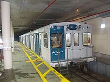
[19] The resort opened in July 1987 and despite transport difficulties (caused by the delay in the completion of the Skitube alpine railway beyond Perisher) the response to the facilities and the mountain was overwhelmingly positive.
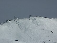
The highest lifted point on the Blue Cow Side of Perisher is 1960m reached by the Summit Quad Chairlift.
In 1991, Guthega was purchased by the Alpine Australia Group Pty Limited, the then operator of the Blue Cow Resort.
This led to the operation of two resorts becoming integrated in 1992, thus providing day access into Guthega via the Skitube alpine railway and the Blue Cow and Link Management Unit ski slopes.
Initially, Skitube alpine railway was designed as a winter based access system to improve entry to the Perisher Range ski fields.
Until then, these areas were served by a single road of limited capacity that was and still often is, adversely affected by snow and ice during winter.
As expected of a ski resort there is a snowpack lasting for several months of the year, sometimes into early summer, however not as long-lasting as equivalent elevations over the western side of the range due to its sheltered location.
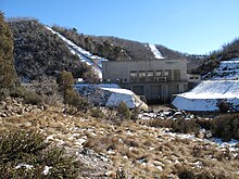
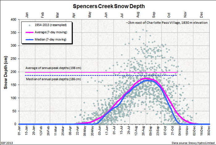
[21] Snow depth measurements are taken by Snowy Hydro at Spencers Creek, approximately 2 kilometres (1 mi) west of Perisher Valley.