Pfeffelbach
Pfeffelbach lies in the heart of the Westrich, an historic region that encompasses areas in both Germany and France, at the edge of the Preußische Berge ("Prussian Mountains") in the Western Palatinate.
On the valley's north side, the Preußische Berge rise up to heights of almost 600 m above sea level in a long ridge (Teufelskopf 582 m, Spitzerberg 577 m, Herzerberg 585 m).
It rises just below Schwarzerden, a constituent community of Freisen in the Saarland, and after flowing for just under 6 km, it empties into the Kuselbach in Kusel's outlying centre of Diedelkopf.
The streets in Pfeffelbach's old built-up area run in an almost star-shaped pattern towards the church, whose location may well be considered the village's point of origin.
Branching off the highway to the south here is Hauptstraße ("Main Street"), which then crosses the brook and turns eastwards to run through the edge of the more heavily built-up area.
[4] The oldest traces of the past in Pfeffelbach go back to Roman times, namely a piece of an old gravestone used as spolia in the churchtower showing the upper parts of a man's and a woman's bodies with the inscription "D M" (Dis Manibus – "to the Di Manes").
[5] Pfeffelbach may have been founded in the so-called Remigiusland, which, it is highly likely, was donated towards the end of the 6th century to the then Bishopric of Reims by the Merovingian Frankish King Childebert II.
Shortly before this, Pfeffelbach's first documentary mention, the Remigiusland had been handed over to Count Gerlach I from the Nahegau as a Vogtei (1121), who took this and other Vogteien that he held from the Archbishopric of Mainz and the Bishopric of Reims, along with some of his own holdings, and founded the County of Veldenz.
In 1316, F. X. Glasschröder's Neue Urkunden zur pfälzischen Kirchengeschichte ("New Documents About Palatine Church History") mentioned the village as Peychnillenbach.
Pfeffelbach remained a seat within this state, now of an Unteramt, itself within the Oberamt of Lichtenberg, which had now been expanded into ten Schultheißereien, and whose capital was moved to Diedelkopf.
To add to these woes, a fire broke out in Pfeffelbach the following year, destroying several houses including the rectory, barns and stables.
Churchwarden Preuel wrote in a report dated 10 August 1613: "Last Friday, a great fire raged, in which the rectory, the barn, the stable and other buildings in the village were destroyed."
Jahrhunderts ("Decay and Destruction in the Rhine Area During the 17th Century"), Pfeffelbach appears among the villages burnt down by King Louis XIV's armies.
In the course of territorial reorganization, Pfeffelbach was grouped into the Department of Sarre, the Arrondissement of Birkenfeld, the Canton of Kusel and the Mairie ("Mayoralty") of Burglichtenberg.
As part of this state, Pfeffelbach passed in 1834 by sale – the price was 2,100,000 Thalers – to the Kingdom of Prussia, which made this area into the Sankt Wendel district in the Rhine Province.
Later, after the First World War, the Treaty of Versailles stipulated, among other things, that 26 of the Sankt Wendel district's 94 municipalities had to be ceded to the British- and French-occupied Saar in 1919.
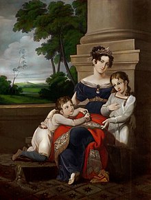
The Duchess's embalmed body had at first been kept at the Schlösschen ("little palace") at Sankt Wendel, but then, as a result of sinister intrigues within the House of Saxe-Cobourg, somehow went astray.
On 9 June 1846, the late Duchess's coffin was raised and there followed another translation, this time to Coburg, where it at first lay at the town church, before being moved to the mausoleum on the Glockenberg in 1860.
Paving stones from this quarry and others that were subsequently opened were shipped by horse and cart to Kusel and for a time even to Sankt Wendel.
On 10 May 1896, to commemorate the conclusion of a peace treaty with France that put an end to the Franco-Prussian War on 10 May 1871 – thus on the 25th anniversary of its signing – the veterans’ association, which had been established only the year before, planted the so-called Bismarckeiche ("Bismarck Oak").
On 16 August 1917, a commercial survey was undertaken, which yielded the following data: two stone quarrying businesses, three innkeepers, four traders, two bakers, two cabinetmakers, two smiths, one turner, one plumber, two butter and milk dealers, two shoemakers, three gristmills, two butchers, one insurance agent, three wheelwrights, one sculptor, one tailor, one shaver, one house painter and two midwives.
Those who were not self-employed worked in crafts, business, stone quarries, Saar mines, the ironworks in Neunkirchen am Potzberg and in a few cases even in the building trade.
In 1964, passenger rail service between Kusel and Schwarzerden came to an end, and beginning on 1 June 1967 the railway line closed entirely with the suspension of goods transport as well.
The flooding problem in Pfeffelbach's "Pfarracker" led in October 1995 to a planning contract being awarded to the engineering office of Schöer from Waldmohr.
The prefix might, for instance, have something to do with the word "Paffen" or "Pfaffen" (German for "clerics" or "parsons" – a usage now considered disparaging), which would point to the village's having arisen in the Early Middle Ages near a monastery.
Herzweiler lay near the municipal limit with Reichweiler and was likely forsaken as long ago as the 15th century, but references to it still crop up in rural cadastral toponyms, such as Herzerberg.
According to the 1124 document, Pfeffelbach was, along with Konken and Altenglan, one of three chapels of ease of the Church of Kusel, and was said to be held by the Abbey of Saint-Remi but belonged with regard to ecclesiastical organization to the Archbishopric of Mainz.
The charge on the upper field of the escutcheon, the demilion ("half" lion, cut off at the waist) is a reference to the village's former allegiance to the County of Veldenz.
[21] The following are listed buildings or sites in Rhineland-Palatinate's Directory of Cultural Monuments:[22] Twice each year in Pfeffelbach, an autocross race is held on the abandoned stone quarry lands.
Proposals to expand the school carried on at length, until in the end Mayor Edmund Müller, on his own initiative, had a pavilion built that solved the space problem, at least at first.