Polesine
[2] The eastern portion of Polesine corresponds to the delta of the Po, and it is constantly expanding eastward because of the detritus sediment phenomenon.
After the fall of Rome and the disasters in the hydrography of the whole Veneto, traditionally referred to as the breach at Cucca in 589, Adria and its port lost their significance.
In 1152, another disaster changed the hydrography of Polesine: a breach opened in the banks of the Po at Ficarolo and the new main course started flowing much closer to the Adige.
All these areas established the Territory of Polesine inside the Domini di Terraferma (Mainland State) of the Republic of Venice.
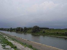
The main floods had been: Actual Polesine territory is, geologically speaking, of recent formation, created by drifts taken by rivers Po and Adige, and subsequently from human modifications.
Contemporary to the rising of Alps and Apennine Mountains, the entire Padania was filled by a long inlet (the Adriatic depression) and the seabed of this huge ditch was full of troughs and elevations.
Floods frequently happened in Polesine filled the depressions of the area with several bundles of sediments consisting in sand, clay and silt.