Potteric Carr
To the west of the road from Rossington Bridge into Doncaster, Leland passed the "largely impenetrable morass of bog and fen known locally as Potteric Carr".
Earlier he would have caught glimpses in the east of a similar wild tract of marshy country which then covered the whole of the flat land between the Don and the Trent.
At the time of the Roman occupation much of lowland Britain was open farmland with regimented field systems used for agriculture since the Iron Age, which can be seen in Dr Derick Riley's air photographs of nearby Bawtry Road and Hurst Lane where the Roman Till Bridge Lane runs through the earlier Iron Age field systems.
The idea may have been introduced to the area by Dutch workers who came to Britain with Cornelius Vermuyden who is noted for his drainage schemes in the English Fens and the nearby Isle of Axholme.
The decoy was operated for about 130 years but its closure was foreshadowed in the 1760s when a civil engineer, John Smeaton, carried out the final and most effective drainage scheme so that by the end of the century much of the area was under agriculture.
Thus by the middle of the 19th century the landscape was probably typical of an English rural scene with fields, hedges, trees and larger tracts of woodland all being maintained by the efficiency of the drains.
In 1849, the Great Northern Railway was built across the Carr cutting through the Old Eaa Plantation and the centre of the decoy totally destroying in the process the last refuge of many scarce plants.
Both industries were hungry for land and in 1862 the Great Northern Railway Company purchased 160,000 square metres between the Doncaster-Sheffield road and the decoy for the construction of a marshalling yard for coal traffic.
In the ensuing years, Doncaster expanded considerably, particularly after deep coal seams were found in the district and, in conjunction with this, there was a further expansion of the railway system.
Within the next 20 years several local collieries were opened including Rossington and this resulted in a considerable amount of railway activity in the area, particularly in the inter-war period.
This industrial period, which brought so much activity in the early quarter of the 20th century, considerably fragmented the area though the wildlife for which the Carr was once famous had long since gone.
From this time onwards, however, the effects of subsidence became more severe and by 1963 the eastern side of Low Ellers had been transformed into marsh with a small, but permanent, area of open water.
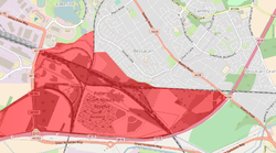
The reserve is bisected by railway lines and half has been designated by Natural England as a Site of Special Scientific Interest (SSSI) for its reed-fen communities.
In July 2022 four Polish konik ponies were released at the site to help manage the marshland, preventing it from becoming overgrown and help create habitats for ground-nesting birds.