Rangeland management
[1] Range management is defined by Holechek et al. as the "manipulation of rangeland components to obtain optimum combination of goods and services for society on a sustained basis".
[3] The earliest form of Rangeland Management is not formally deemed part of the natural science studied today, although its roots can be traced to nomadic grazing practices of the Neolithic Revolution when humans domesticated plants and animals under pressures from population growth and environmental change.
[10] Range management's focus has been expanded to include the host of ecosystem services that rangelands provide to humans world-wide.
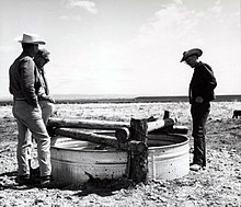
Key management components seek to optimize such goods and services through the protection and enhancement of soils, riparian zones, watersheds, and vegetation complexes, sustainably improving outputs of consumable range products such as red meat, wildlife, water, wood, fiber, leather, energy resource extraction, and outdoor recreation, as well as maintaining a focus on the manipulation of grazing activities of large herbivores to maintain or improve animal and plant production.
"[19] Emerging evidence suggests that rangelands are extremely vulnerable to the threats of climate change,[20] as more severe heatwaves, droughts, evaporation, and catastrophic flood events will consequentially alter ecological states,[21] and negatively affect forage production,[22][23] both of which will negatively impact ecosystem functioning and the sustainable production of ecosystem services.
In an open letter to the White House in 2017, the president of the SRM offered President Trump the society's support in seeking management strategies to mitigate climate-induced phenomenon like drought and forest fires,[24] a subject which was brought to the national debate stage and which has received significant push-back by Trump and his administration.