Rangpur Division
It covers the northernmost part of the country with a population of about 18 million inhabitants within an area of 16,184.99 km2 (6,249.06 sq mi).
Mughalbasa and Mughalhat of Kurigram district still bear marks of the Mughal rule in the region.
Rangpur Division has 8 Districts, 58 Upazilas, 1 City Corporation, 21 Pourasavas and 536 Union councils.
Once considered the poorest division in Bangladesh, with over a third of the population living in extreme poverty in 2016, according to World Bank data,[10] Rangpur has seen a major transformation, largely driven by industrial growth and improved infrastructure.
The establishment of manufacturing units for ceramics, electronics, and consumer goods has stimulated the local economy, creating jobs and attracting investment.
The expansion of natural gas lines, better road infrastructure, and enhanced rail connectivity have been crucial to supporting these industries, allowing for more efficient production and distribution across the region.
While agriculture remains important, with Rangpur being a key producer of rice, potatoes, and sugarcane, it is the rise of industry and infrastructure that has accelerated the division’s economic progress.
This industrial and infrastructural growth reflects the determination and innovation of the people, transforming Rangpur into a region of increasing prosperity.
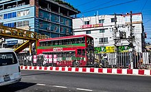
Rangpur has good road, rail and air communications with the capital as well as other parts of the country.
There are a total of 21 express trains which connect different districts of the division with the capital and other parts of the country.
Rangpur city serves as the hub for medical treatments in the division, though for specialized or critical cases, patients travel to Dhaka or abroad.