Red Deer River
A glacial flood about 18,000 years ago eroded out a portion of this basin and apparently all or most of the scenic badlands bearing the dinosaur and other Cretaceous fossils.
[4] In June 2013, Alberta, Canada, experienced heavy rainfall that triggered catastrophic flooding throughout much of the southern half of the province along the Bow, Elbow, Highwood, Oldman, and Red Deer rivers and tributaries.
Twenty-four municipalities declared local states of emergency as water levels rose and numerous communities were placed under evacuation orders.
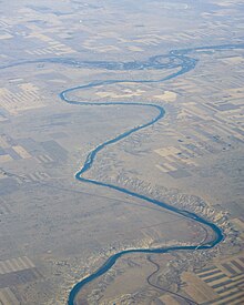
[7] The river originates on the eastern slopes of the Canadian Rockies, in the Sawback Range near the Skoki Valley inside Banff National Park, and then flows east through the mountains and foothills region.
[13] Increased water flow of the Red Deer River system during heavy rainfall in June 2008 eroded supporting soil, freely exposing a section of Pembina Pipeline Corporation's Cremona crude oil pipeline to the Red Deer River currents.
[16] Heavy rains in early June 2012 caused a similar but larger leak on a Plains Midstream Canada 46-year-old pipeline on a Red Deer River tributary, Jackson Creek, Alberta (51°52′19″N 114°36′23″W / 51.87194°N 114.60639°W / 51.87194; -114.60639 (Jackson Creek)[17]) near Gleniffer Lake and Dickson Dam,[18] which spilled approximately 1,000 and 3,000 barrels (160,000 and 480,000 L; 35,000 and 105,000 imp gal; 42,000 and 126,000 US gal) of light sour crude oil into the Red Deer River.
[16][19] Red Deer has a humid continental climate (Köppen Dfb), with something of a semi-arid influence due to the city's location within Palliser's Triangle.
Winters are long, cold and dry, while summers are short, but with average daytime highs that are warm to hot, though nighttime lows are cool.