Restrictions on geographic data in China
Under Chinese law, the use of geographic information in the People's Republic of China is restricted to entities that have special authorization from the administrative department for surveying and mapping under the State Council.
The law prohibits:[4] publishing, without authorization, significant geographic information and data concerning the territorial air, land and waters, as well as other sea areas under the jurisdiction of the People's Republic of China.
[6] The media has reported on other cases of unlawful surveys: As a consequence, major digital camera manufacturers including Panasonic, Leica, FujiFilm, Nikon and Samsung restrict location information within China.
[20] Technical spatial processing must be applied to electronic navigational maps prior to publication, sales, redistribution, and usage.
[22] It uses an obfuscation algorithm[23] which adds apparently random offsets to both the latitude and longitude, with the alleged goal of improving national security.
[27] Despite the secrecy surrounding the GCJ-02 obfuscation, several open-source projects exist that provide conversions between GCJ-02 and WGS-84, for languages including C#,[28] C, Go, Java, JavaScript, PHP,[29] Python,[30] R,[20] and Ruby.
[34] An attempt by Wu Yongzheng using fast Fourier transform analysis gave a result much like the leaked code.
[citation needed] However, the open-source "reverse" transformations make use of the properties of GCJ-02 that the transformed coordinates are not too far from WGS-84 and are mostly monotonic related to corresponding WGS-84 coordinates:[39][20] The rough method is reported to give some 1~2 meter accuracy for wgs2gcj,[29] while the exact (fixed point iteration) method is able to get "centimeter accuracy" in two calls to the forward function.
[20] The establishment of working conversion methods both ways largely renders obsolete datasets for deviations mentioned below.
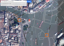
[41] The China GPS shift (or offset) problem is a class of issues stemming from the difference between the GCJ-02 and WGS-84 datums.
[41] Satellite imagery and user-contributed street map data sets, such as those from OpenStreetMap also display correctly because they have been collected using GPS devices (albeit technically illegally).
[43] Google has worked with Chinese location-based service provider AutoNavi since 2006 to source its maps in China.
The issue has been reported numerous times on the Google Product Forums since 2009,[47] with 3rd party applications emerging to fix it.