Circle of the Rhine
[4] The territory remained Bavarian until 30 August 1946, with the exception of the area detached in 1920, which roughly corresponded to the present day Saarpfalz-Kreis.
As a result of the Treaty of Campo Formio (1797) the First French Republic annexed the region and introduced an administrative system in 1798.
Following the defeat of Napoleon at the Battle of Leipzig in 1813 and the capture of the Left Bank of the Rhine by the Allies in January 1814, from 2 February 1814 the region was initially under the provisional authority of the General Government of the Middle Rhine, but, from 16 June that same year, it was placed under the administration of the Imperial-Royal Austrian and Royal Bavarian Joint Land Administration Commission (k. k. östreichischen und k. bairischen gemeinschaftliche Landes-Administrations-Kommission).
[6] In the main treaty agreed at the Congress of Vienna in 1815, and dated 9 June 1815, Article 51 stated that (inter alia) on the Left Bank of the Rhine the former départements of the Sarre and Mont-Tonnere, except where stated in the same treaty, were to go "with full sovereignty" and ownership rights under the overlordship of the Emperor of Austria (Herrschaft Sr. Maj. des Kaisers von Oesterreich).
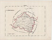
In accordance with the prevailing Bavarian administrative structure, the region was given the name "Rhine Circle" (Rheinkreis) with Speyer as its capital.