Richland Creek (Nashville, Tennessee)
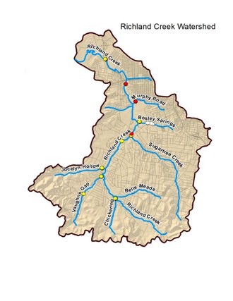
[1] It winds for 28 miles (45 km) through the Nashville suburbs of Belle Meade and Forest Hills[2] and eventually flows into the Cumberland River near Rock Harbor Marina at the end of Robertson Avenue.
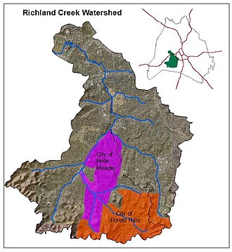
[1] The Richland Creek Watershed consists of 17,712 acres (27.675 sq mi) within the city of Nashville, approximately 4 miles west of downtown.
Richland Creek then flows past Congregation Ohabai Sholom, picks up some small springs and crosses under Harding Road (Highway 70 South) near the intersection of Belle Meade Boulevard.
From this point, Richland Creek meanders behind St. Thomas Hospital and Aquinas College in a northerly path along White Bridge Road.
As of 2016, this area included a rock quarry, a concrete mixing facility and several large petroleum bulk storage terminals.
The study found that Richland Creek was being polluted not only by private industries but also by the sewer system of Nashville's Metropolitan Government.
[10] As of 2016, there continues to be a public health and safety contact advisory placed on Richland Creek because of chronic sewer issues– it is on The Tennessee Department of Environment and Conservation (TDEC) 303(d) "List of Impaired Waterbodies".
[4] In 2011, Montgomery Bell Academy began work on a geothermal installation on school property adjacent to West End Avenue.
[13] This includes two above-ground tanks large enough to temporarily hold 31 million gallons of liquid when sewer flow exceeds the capacity of the treatment plant.
[15] In the aftermath, Metro Government acquired 61 flood-damaged homes in the Delray Drive area along the course of Richland Creek.
The homes were torn down to develop England Park— a green space which helps absorb excess water from Richland Creek during any future flooding.