Santa Ana River
Due to low regional rainfall, the river carries only a small flow except during the brief winter season, when it is prone to massive flash floods.
The San Jacinto River, which drains the southern half of the watershed, rarely reaches the Santa Ana except in extremely wet years.
[15] Temescal Creek drains the largest area of all the tributaries, because it provides the outflow from Lake Elsinore, into which the San Jacinto River flows.
Except during the wettest years when Lake Elsinore fills high enough to overflow, Temescal Creek contributes little to no water into the Santa Ana River.
Downstream of there, the river is mostly confined to a concrete channel, serving only for flood control and urban runoff drainage, and is usually dry or a small trickle.
[14][17] The Santa Ana River drains the largest watershed of California's South Coast region,[15] covering 2,650 square miles (6,900 km2) in parts of San Bernardino, Riverside, Orange and Los Angeles Counties.
All of the Islands in Newport Harbor are the product of dredging and man made forming from the sands and silt deposited over time by the Santa Ana River.
Most of the strata in the flat valleys and basins of the watershed are underlain by thousands of feet of sediment deposited by shallow seas that covered parts of Southern California in ancient times.
Even during the ice ages, Southern California mountains were not subjected to extensive glaciation, so the rock has remained for tens of millions of years without significant erosion.
The Santa Ana River, which existed prior to the creation of the Peninsular Ranges, maintained its course as an antecedent stream due to its increased erosive power.
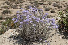
The scrub oak is one of the most common plants in chaparral regions, forming a dense groundcover that makes it difficult for humans and large animals such as mountain lions, coyotes, and bobcats to traverse.
[34] Perennial and seasonal streams often are lined with live oak and sycamore, which transition into the riparian zones of the main stem Santa Ana River.
The largest unbroken riparian corridor is the 20-mile (32 km) stretch between Riverside and Prado Dam, where the river has been largely left in its natural state despite pollution from urban runoff.
[40] Despite the rarity of steelhead, in recent years fin samples from 13 trout were collected from Harding Canyon in the Santiago Creek tributary of the Santa Ana River and genetic analysis has shown them to be of native and not hatchery stocks.
To support its fast growth rate, the giant reed population in the Santa Ana River watershed can consume 56,200 acre-feet (69,300,000 m3) of water per year.
[45] Human habitation on the Santa Ana River dates back 9,000 to 12,000 years ago, close to the early stages of the Holocene period.
[46] About 8,000 years ago, the climate experienced a change becoming more arid and the originally nomadic tribes began to stay in individual places longer, becoming semi-nomadic.
They were also the larger of the two groups, controlling all the coastal lands from the San Gabriel Mountains in the north to Aliso Creek in the south, including all of the Los Angeles Basin.
[6][7] When Spanish explorer Juan Rodriguez Cabrillo sailed along the Southern California coast on his voyage of 1542, he passed the mouth of the Santa Ana River without noting it.
It was not until 1769 that Gaspar de Portolà led the first overland expedition northwards through coastal Southern California—still a largely unexplored part of the Alta California province of New Spain—and gave the river its name.
Fray Juan Crespí, one of the members of the expedition, wrote in his diary that he called the spot "Jesus de los Temblores", referring to an earthquake that struck while they were camped alongside there.
[49] Crespi also noted that the soldiers were calling the river "Rio de Santa Ana", probably because they had recently celebrated Saint Anne's Day.
[28] A flood that raged down the Santa Ana in 1825 caused the river's course to change temporarily to an outlet at Newport Bay, depositing sediment that partially created Balboa Island.
[56] When the California Republic was assimilated into the United States in 1848, American settlers began to move into the Santa Ana River region in great numbers.
[48] In 1860, a much closer gold rush occurred in the San Bernardino Mountains when prospector William Holcomb discovered significant deposits, just over the northern drainage divide of the Santa Ana River.
[56] The Santa Ana River served as a conduit for miners traveling to the region and many of the forests in the upper basin experienced clearcutting as a result of the high resource demands of the boom.
Despite all of the hardships experienced in the three years, after conditions finally returned to normal, the Santa Ana River watershed again became a prospering agricultural region.
[63] With the increased flood protection afforded by the Prado Dam, major industrial development migrating south from the Los Angeles Basin, and the Southern California housing boom in the 1950s and 1960s, the Santa Ana River watershed began its third and final transition—from agricultural to urban.
[55] The population of the Santa Ana River basin increased dramatically, but brought with it the threat of greater damage from floods, somewhat compromising the protection afforded by Prado Dam.
Most of the flow in the river below the city of San Bernardino consists of effluent from 45 wastewater treatment plants and dry season urban runoff, which is collected behind Prado Dam.