Olef
The Olef rises on the Ramscheider Höhe, near the Zitter Forest, about 2.2 km (1.4 mi) southwest of Hollerath at an elevation of 639 m above sea level (NHN), immediately on the state border.
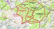
It then forms inter alia, the eastern boundary of the safety zones of the Elsenborn Military Training Area.
At the end of the village of Hellenthal, near Kirschseiffen, the river turns north.
Other villages en route are Oberhausen, Schleiden, Olef, Nierfeld and Gemünd.
Along its 27.9-kilometre-long route the Olef descends through 335 metres, which represent an average riverbed gradient of 12 ‰.