Ottawa River
The river rises at Lac des Outaouais, north of the Laurentian Mountains of central Quebec, and flows west to Lake Timiskaming.
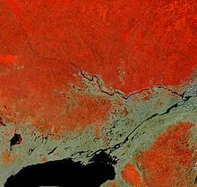
[3] The river flows through large areas of deciduous and coniferous forest formed over thousands of years as trees recolonized the Ottawa Valley after the ice age.
[4] Generally, the coniferous forests and blueberry bogs occur on old sand plains left by retreating glaciers, or in wetter areas with clay substrate.
The deciduous forests, dominated by birch, maple, beech, oak and ash occur in more mesic areas with better soil, generally around the boundary with the La Varendrye Park.
[9] Associated with the logging and early settlement were vast wild fires which not only removed the forests, but led to soil erosion.
Shirleys Bay has a biologically diverse shoreline alvar, as well as one of the largest silver maple swamps along the river.
There are four herbaceous vegetation types, named for the dominant plant species in them: Scirpus, Eleocharis, Sparganium and Typha.
[238] Clay deposits from this period have resulted in areas of poor drainage, large swamps, and peat bogs in some ancient channels of this river.
As the land gradually rose again the sea coast retreated and the fresh water courses of today took shape.
Thereafter Lake Nipissing drained westward, through the French River which later became a link in the historic canoe route to the West.
[241] As it does to this day, the river played a vital role in life of the Algonquin people, who lived throughout its watershed at contact.
For the following two centuries, this route was used by French fur traders, voyageurs and coureurs des bois to Canada's interior.
In 1800, explorer Daniel Harmon reported 14 crosses marking the deaths of voyageurs who had drowned in the dangerous waters along this section of the Ottawa.
In the early 19th century, the Ottawa River and its tributaries were used to gain access to large virgin forests of white pine.
A scattering of small subsistence farming communities developed along the shores of the river to provide manpower for the lumber camps in winter.
In 1950, the dam at Rapides-des-Joachims was built, forming Holden Lake behind it and thereby submerging the rapids and portages at Deux Rivières.
[243] These hydro dams have had negative effects upon shoreline and wetland ecosystems,[245] and are thought to also be responsible for the near extermination of American eels, which were once an abundant species in the river, but which are now uncommon.
[248] This section of the Ottawa River is known for its whitewater, and is used by a number of commercial rafting companies and many recreational kayakers and canoeists.