Romblon
The province lies south of Marinduque and Quezon, east of Oriental Mindoro, north of Aklan and Capiz, and west of Masbate.
"[4] The islands of the province have a number of white sand beaches, diving spots, mountains and rainforests that tourists visit.
Sibuyan island is an ecotourism destination, having been dubbed by some as "the Galápagos of Asia" because it has remained in isolation from the rest of the world since its formation.
[5] According to legend, the name "Romblon" was derived from the Romblomanon word Nagalumyom, which pertains to a chicken in the act of sitting on its eggs on a nest.
[8] Meanwhile, Reyes claims Romblon originated from "doubloon", which refers to the Spanish coin used by Moro pirates in paying dowries for their brides-to-be.
[11] Remnants of Negrito and Mangyan aborigines now live in the mountains of Tablas and Sibuyan after they were displaced by the influx of Hiligaynon, Aklanon, Bicolano and Tagalog migrants as early as 1870.
In 1868, they established seven missionary centers at Romblon, Badajoz (San Agustin), Cajidiocan, Banton, Looc, Odiongan and Magallanes (Magdiwang).
More than a century later in 1850, the inhabitants of the province began using Spanish family names after governor-general Narciso Clavería decreed on 21 November 1849 the use of surnames from the Catálogo alfabético de apellidos.
Romblon was created as a regular province in the same year but due to insufficient income, it became a sub-province of Capiz again from 15 July 1907 until 22 February 1918,[20] when Act No.
581, enacted without executive approval on 8 June 1940, the province was reorganized with four towns or municipalities, namely: Tablas (composed of Odiongan, Looc, and Badajoz), Romblon (including the islands of Logbon, Cobrador and Alad), Maghali (comprising Banton, Corcuera, and Concepcion), and Sibuyan (composed of the towns of Cajidiocan, Magdiwang and San Fernando).
The movement was led by the Free Panay Guerilla Forces composed of members from the 6th Military District under the direction of Col. Macario Peralta, Jr.[13][25] One of the major naval engagements during the Battle of Leyte Gulf, the Battle of Sibuyan Sea, happened off the waters of Romblon on 23–24 October 1944 between Japanese Admiral Kurita’s fleet from Singapore and Admiral Halsey's carrier planes from the US Third Fleet then stationed east of the Philippines.
103 by then-President Gloria Macapagal Arroyo dated May 17, 2002, Romblon was made part of Mimaropa, officially Southwestern Tagalog Region.
The western portion of the island may be characterized as extensively rugged, having ascents of 60 percent or more while the eastern section is relatively undulating to rolling.
Romblomanon belongs to the Central Visayan subgroup, which spans from Waray-Waray in Samar and Leyte, through Masbatenyo and Sorsoganon, and as far west as Hiligaynon and Capiznon on Panay.
[55][56] Onhan, on the other hand, belongs to the Western Visayan subgroup, which includes Kinaray-a and Aklanon, as well as several minor languages spoken on Mindoro, Palawan, and some small islands in between.
As Romblon is part of Mimaropa which is also known as Southwestern Tagalog Region, provincial settlers speak Tagalog/Filipino as lingua franca between different Visayan languages.
The provincial economy is heavily reliant on agriculture, tourism and mineral extraction which can be greatly affected by typhoons the frequently pass through the province yearly.
Odiongan, Banton and Magdiwang have the greatest areas planted with root crops and correspondingly, have the highest volume of production.
The provincial government maintains breeding facilities in strategic locations province-wide to encourage farmers to engage in livestock and poultry production to augment their income.
[13][33] Due to the geographical condition of the province, crops and livestock production is generally deficient as compared to the food requirements of Romblon population.
In Romblon town, the forts of San Andres and Santiago served as fortifications against Muslim pirates in the 17th century, while the St. Joseph Cathedral and Belfry houses a centuries-old image of the Santo Niño de Cebú or the Holy Child.
[81] In that week, a fluvial parade featuring the image of the Santo Niño goes around Romblon Bay in order to bring good luck to the villages.
[81] A similar Biniray Festival also occurs in Banton every 10 September in commemoration of the island's patron, San Nicolas de Tolentino.
It has pristine and untouched reefs with almost undisturbed hard and soft corals around the islands of Romblon, Logbon, Alad and Cobrador.
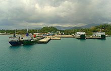
The primary modes of land transportation in the province are jeepneys, passenger motorcycles, minibuses and tricycles that serve inter-municipal movements and linkages.
[13][33] In 2013, TIELCO has entered into a 15-year power supply agreement with Sunwest Water and Electric Company (SUWECO) to fill the island's energy needs.
[99] Likewise, TIELCO supplies electricity to San Jose and has recently held the bidding for the competitive selection process (CSP) for a new power provider to the island municipality.
[104][105] ROMELCO also provides 24-hour electricity to the island municipalities of Banton, Concepcion and Corcuera through diesel power plants operated by the NPC.
[113] The province has several operating telecommunication exchanges, namely Kayumanggi, Romblontel, Odiongan Telephone Corporation (OTELCO), the Telecommunication Office (TELOF), telegram system, Liberty Telecom, public calling stations under the Department of Transportation (DOTr) and the Provincial Communication System (PCS) radio transceivers and receivers.
[13][33] There are four radio stations in the province, two of which are operated by the Radyo Natin Network and the other, 95.7 FMR Romblon owned by the Philippine Collective Media Corporation, GM FM 100.5 MHz owned by the Polytechnic Foundation of Cotabato and Asia and Radyo Natin Network operates the call sign DWMM at 104.5 MHz on FM radio from Looc, as well as the call sign DZVG 101.3 MHz on FM radio from Odiongan owned by Manila Broadcasting Company.