Route of the Lincoln Highway
The original route of Lincoln Highway came off the New York Central Railroad's ferry at Weehawken Terminal and climbed the Palisades on Pershing Road.
Some sources indicate the Highway bypassing the corner of Hudson County Boulevard and Communipaw Avenue by passing through Lincoln Park, which had been the route of Newark Plank Road.
In downtown Newark at Four Corners, it turned south on Broad Street, at what was claimed to be the "third busiest traffic center in the United States".
After construction of the Holland Tunnel the ferry portion was abandoned and traffic travelled over Bergen Hill to connect with Hudson Boulevard.
The path of the Lincoln Highway was first laid out in September 1913; it was defined to run through Canton, Ohio, Beaver Falls, Pittsburgh, Greensburg, Ligonier, Bedford, Chambersburg, Gettysburg, York, Lancaster and Philadelphia, Pennsylvania, and Camden, New Jersey.
This original 1913 path of the Lincoln Highway continued east from Philadelphia, crossing the Delaware River to Camden, New Jersey on the Market Street Ferry.
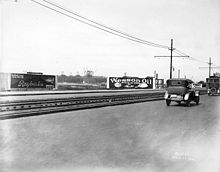
The Lincoln Highway did not enter West Virginia until 1927, when it was rerouted between Pittsburgh, Pennsylvania and East Liverpool, Ohio.
Lincoln Highway enters Illinois on the eastern border in Sauk Village, as Joliet Street in Dyer separates from being one Native American trail into two separate paths: the current route of Lincoln Highway turns north to cross Ford Heights and Chicago Heights at 14th Street, and the original route following Sauk Trail to South Chicago Heights before turning north on Chicago Road.
When originally designed, Lincoln Highway crossed the Fox River near downtown at Benton Street and Downer Place, following Lake Street (IL-31) to Geneva, where the road shifted to leave the Chicago area and extend west towards the Iowa border.
The longest stretch of original Lincoln Highway brick roadway in the country is in Omaha from approx.
From Fremont, it continued west on U.S. Route 30 through Central City, Grand Island, Wood River, Kearney, Lexington, Cozad, Gothenburg, North Platte, Sutherland, Ogallala, Chappell, Sidney, and Kimball to the Wyoming state line.
The 1913 proclamation included a loop through Denver, Colorado, touching the main route at Big Springs, Nebraska and Cheyenne, Wyoming.
This loop was included, as Colorado had felt betrayed by the decision not to run through it after supporting the Hoosier Tour earlier that year.
It followed US Route 30 (now largely Interstate 80) through Cheyenne, Laramie, Medicine Bow, and Rawlins to Granger Junction.
The Lincoln Highway entered Utah on modern Interstate 80 to Echo Junction where it joined I-84 and followed the Weber River to Ogden.
From Timpie it turned south roughly along present State Route 196, past Iosepa, to Orr's Ranch (40°18′23″N 112°44′06″W / 40.306334°N 112.734897°W / 40.306334; -112.734897).
The Lincoln Highway then went west past Fish Springs (39°50′53″N 113°24′40″W / 39.848°N 113.411°W / 39.848; -113.411) and Callao (39°53′53″N 113°42′32″W / 39.898°N 113.709°W / 39.898; -113.709) and across the Deep Creek Range through the Overland Canyon (40°04′01″N 113°49′44″W / 40.067°N 113.829°W / 40.067; -113.829) to Ibapah (40°02′10″N 113°58′59″W / 40.036°N 113.983°W / 40.036; -113.983), crossing into Nevada soon after.
At Orr's Ranch it rejoined the old road west to County Well (now the Dog Area of the Dugway Proving Ground), where the Goodyear Cutoff began.
The Goodyear Cutoff cut largely across the Great Salt Lake Desert, hitting high areas at Granite Mountain (40°10′26″N 113°17′46″W / 40.174°N 113.296°W / 40.174; -113.296) and Black Point (40°05′06″N 113°40′05″W / 40.085°N 113.668°W / 40.085; -113.668), and then passing through the Deep Creek Mountains via Gold Hill (40°09′58″N 113°49′52″W / 40.166°N 113.831°W / 40.166; -113.831) and rejoining the older route about halfway from Gold Hill to Ibapah (40°06′18″N 113°51′50″W / 40.105°N 113.864°W / 40.105; -113.864).
The Sierra Nevada Southern Route from Stateline, Nevada and Lake Tahoe to Sacramento followed the Pioneer Trail and Meyers Grade Road to the top of Echo Summit, then westbound on Johnson Pass Rd to US 50, then westbound on 50 (with many adjacent parallel jogs on mountain roads) through Twin Bridges, Strawberry, Kyburz, Whitehall, Riverton, and Pacific House.
At Pollock Pines, the route followed the Pony Express Trail and Carson Road to Broadway and Main Street in Placerville.
It continued west on Altamont Pass Rd arriving in Livermore via Northfront Rd, Vasco Rd, First St and Junction Ave. From Livermore, the route followed today's I-580 westbound into Dublin, then Dublin Canyon Rd, East Castro Valley Rd, Grove Way and A Street into downtown Hayward.
Upon the completion of the first Carquinez Strait Bridge at Vallejo in 1927, the Lincoln Highway from Sacramento to San Francisco was re-routed over this much shorter alignment.
West of Davis the route followed old US 40 as it "stairstepped" through the towns of Dixon from I 80, beginning at CA 113 south to Vacaville, Fairfield, Rockville, and Cordelia.
Arriving in San Francisco from 1913 to 1921, you departed the ferry from Oakland at the Ferry Slips at the south end of the Ferry Building, drove west on Market St, right on Van Ness Ave, left on Chestnut St (past the 1915 Panama-Pacific Exhibition), entered the Presidio via the Lombard Gates, departed the Presidio via the Arguello Gates, right on Lake St, left on El Camino del Mar, entering into Lincoln Park from the northwest.
Arriving in San Francisco in 1928, you departed the ferry from Berkeley at the Hyde Street Pier, drove south on Hyde, right on North Point St, left on Van Ness Ave, right on California St, right on 32nd Avenue, left on El Camino del Mar, entering into Lincoln Park from the northwest.
The Western Terminus Marker and the Interpretive Plaque is located at the southeast corner of the plaza, next to the bus stop, adjacent to the entrance drive leading up from 34th Ave.