Royal Canal
The length of the canal to the River Shannon was reopened on 1 October 2010, but a final spur branch, to Longford Town, remains closed.
In 1755, Thomas Williams and John Cooley made a survey to find a suitable route for a man-made waterway across north Leinster from Dublin to the Shannon.
They originally planned to use a series of rivers and lakes, including the Boyne, Blackwater, Deel, Yellow, Camlin and Inny and Lough Derravaragh.
Work on this massive project commenced in May 1790 at Cross Guns Bridge, Phibsborough in a westerly direction towards Ashtown.
[5] To counteract this, a small reservoir named after King George III was opened in the north inner city in 1809, paid for by Dublin Corporation, which was fed from the 1km-long spur that came off the Royal Canal to meet Broadstone railway station near Phibsborough.
[9][10] In May 1847, during the Great Famine, tenants of Major Denis Mahon, left his Strokestown Park estate in County Roscommon.
Weakened by starvation, the 1,490 walked for days along the towpaths of the Royal Canal to Dublin, where they were put on boats to Liverpool, and from there travelled to Grosse Île, Quebec on four "coffin ships" – cargo vessels that were also, ironically, loaded with grain from Ireland,[citation needed] and were unsuitable for passengers.
Competition from the railways gradually eroded the canal's business and by the 1880s annual tonnage was down to about 30,000 and the passenger traffic had all but disappeared.
[5] A decade later, in 1961, CIÉ closed the navigation on the canal, and placed a dam across it "three miles west of Mullingar, thereby cutting off the main water supply to the western section".
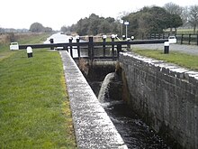
The Royal Canal was originally planned to terminate in Dublin at Broadstone, to serve the then fashionable area of residence, as well as King's Inns and the nearby markets, but it was extended so that now, at the Dublin end, the canal reaches the Liffey through a wide sequence of dock and locks at Spencer Dock, with a final sea lock to manage access to the river and sea.
[11] Access points currently exist near Leixlip and at Maynooth, Enfield, Thomastown, Mullingar, Ballinea Bridge and Ballynacargy.
[12] In 2015, Dublin City Council began extending the walking and cycling route along the Royal Canal from Ashtown to Sheriff Street Upper.
The Royal Canal Way connects with the Westmeath Way west of Mullingar and will eventually form the eastern end of the Dublin-Galway Greenway, the final part of EuroVelo Route 2, a cycling path from Moscow across Europe to Galway.
A monument featuring Behan sitting on a bench was erected on the canal bank at Binn's Bridge in Drumcondra in 2004.