Battle of Ruapekapeka
Royal Navy East India Co. British Army Ordnance HM Treasury Auckland Militia Maori Allies The Battle of Ruapekapeka took place from late December 1845 to mid-January 1846 between British forces, under command of Lieutenant Colonel Henry Despard, and Māori warriors of the Ngāpuhi iwi (tribe), led by Hōne Heke and Te Ruki Kawiti, during the Flagstaff War in the Bay of Islands, New Zealand.
The battle site was a pā located 20 kilometres (12 mi) southeast of Kawakawa, which was one of the largest and most complex fortifications of its kind in New Zealand; designed specifically to resist British cannon fire.
The pā was named Rua Pekapeka (the Bat's Nest) in relation to deep pihareinga, or dugouts with access through narrow circular entrances above to bomb-proof shelters below, which protected the garrison during bombardment.
The outer walls of the pā had trenches (parepare) in front of and behind palisades that were 3 metres (9.8 ft) high, built using pūriri logs.
[10] There were passages between the front and back trenches (parepare),[7] so that warriors could move forward to fire and return to shelter to reload.
In early December 1845 the Colonial forces, commanded by Lieutenant Colonel Despard, moved by water towards Ruapekapeka and began a two-week advance over 20 kilometres (12 mi) to bring artillery up to the pā.
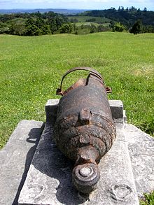
The guns were fired with accuracy throughout the siege causing considerable damage to the palisades, although those inside the pā were safe in the underground shelters.
Tāmati Wāka Nene, Eruera Maihi Patuone, Tawhai, Repa, and Nopera Panakareao led around 450 warriors in support of the colonial forces.
[23] In any event, Māori defenders had limited supplies of gunpowder and shot, such that the possession of these guns did not assist them in the defence of Ruapekapeka.
For the record, Captain William Marlow, RE, Lieutenant Leeds, HEICN, and John Peter du Moulin, Commissariat, surveyed Ruapekapeka soon after the battle and produced the plan and sectional views of the pa from which drawings and models since have been derived.
[33]: 121–127 Lieutenant Henry Colin Balneavis,[34] 58th Regiment, who took part in the siege, commented in his journal for 11 January:Pa burnt.
A large embankment in rear of it, full of under-ground holes for the men to live in; communications with subterranean passages enfilading the ditch.
Reverend Richard Davis noted in his diary of 14 January 1846:Yesterday the news came that the Pa was taken on Sunday by the sailors, and that twelve Europeans were killed and thirty wounded.
[7][33]: 76–84 After the battle Kawiti and his warriors, carrying their dead, travelled some 4 miles (6.4 km) north-west to Waiomio, the ancestral home of Ngāti Hine.
[28]: 28 Lieutenant Henry Balneavis, 58th Regiment, created a model of Ruapekapeka pā as a part of the New Zealand showcase at the Great Exhibition in London, in 1851.