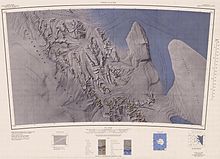
Rutford Ice Stream
Named by US-ACAN for geologist Robert Hoxie Rutford, a member of several USARP expeditions to Antarctica; leader of the University of Minnesota Ellsworth Mountains Party, 1963-1964.
Rutford served as Director of the Division of Polar Programs, National Science Foundation, 1975-1977.
[1] The ice stream is situated in a deep trough which is a tectonic feature between the Ellsworth Mountains and the Fletcher Promontory.
The bed of the ice stream reaches 2,000 metres (6,600 ft) below sea level.
[2] The speed of the Rutford ice stream varies by as much as 20% every two weeks, in response to variations in the tides.