SHETRAN
SHETRAN is a hydrological modelling system for water flow, solute and sediment transport in river catchments.
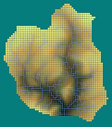
The plan area of the catchment in SHETRAN is usually in the range of one to a few thousand square kilometres and the horizontal depth of the subsurface is usually less than 100m.
In the 1980s the Système Hydrologique Européen (SHE) model was developed by a consortium of three European organizations: the Institute of Hydrology (the United Kingdom), SOGREAH (France) and DHI (Denmark).
The SHE model was renamed SHETRAN at School of Civil Engineering and Geosciences, Newcastle University, after the introduction of the sediment and solute transport component.
This includes the automatic generation of river channels from a Digital elevation model so that a catchment simulation can be set up rapidly.