Saddle Mountains
The Saddle Mountains consists of an upfolded anticline ridge of basalt in Grant County of central Washington state.
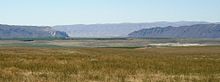
The ridge, reaching to 2,700 feet, terminates in the east south of Othello, Washington near the foot of the Drumheller Channels.
[1] The Cordilleran Glacier diverted the ancient route of the Columbia River 15,000 years ago, backing up water to create Lake Spokane.
Flowing across the current Grand Coulee-Dry Falls region, the ice-age Columbia then entered the Quincy Basin near Quincy, Washington and joined Crab Creek at Moses Lake, following Crab Creek's course southward past the Frenchman Hills and turning west to run along the north face of the Saddle Mountains, there to rejoin the previous and modern course of the Columbia River just above the main water gap in the Saddle Mountains, Sentinel Gap.
It eroded the north face of the Saddle Mountains, creating the conditions for the Corfu Slide.