San Bruno, California
San Bruno City Hall sits at an official elevation of 41 feet (12 m) above sea level.
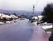
A week-long cold spell in December 1972 caused hard freezes throughout the area, damaging trees and plants and causing some water pipes to break; the temperature dropped as low as 24 °F (−4 °C) at the airport and 20 °F (−7 °C) in Crestmoor, which also reported snow flurries several times that week.
On rare occasions moisture moving up from tropical storms has produced thunderstorms or showers in the summer.
Total annual precipitation, most of which falls from November to April, ranges from 20.11 inches (511 mm) at the nearby National Weather Service station at San Francisco International Airport to over 32 inches (810 mm) in the higher hills (according to observations by Gayle Rucker for the Army Corps of Engineers and Robert E. Nylund for the U.S. Geological Survey from 1962 to 1985).
It offers shaded walkways and hiking trails, picnic tables, a playground, a small ballpark, a municipal swimming pool, and a recreation center that includes an indoor basketball court once used for training by the San Francisco Warriors basketball team.
Junipero Serra County Park, also accessible from Crystal Springs Avenue, is a 100-acre (40 ha) park owned by San Mateo County which includes numerous hiking trails, as well as picnic shelters, barbecue pits, and picnic tables.
The city began as Clarks's Station,[28] a stop on the Butterfield Overland Mail stagecoach route, utilizing an inn built in 1849, which was initially called Thorp's Place and later Uncle Tom's Cabin or 14 Mile House.
[29] The inn was demolished in 1949 and replaced with a Lucky's supermarket (now a Walgreens drugstore, on the corner of El Camino Real and Crystal Springs Avenue).
The railroad eventually became part of the Southern Pacific system, which ran both passenger and freight trains on the line.
Charles Lindbergh was an early visitor to the airport, during his national tour following his successful transatlantic flight; his airplane (Spirit of St. Louis) became stuck in the mud.
[33] Following a campaign by the local newspaper, the San Bruno Herald, the community was incorporated in 1914, mainly so the streets could be paved.
In 1942, after the start of World War II, the local racetrack became the Tanforan Assembly Center, a temporary detention site for Japanese Americans evicted from the West Coast under Executive Order 9066.
[36] Following World War II, there was continued growth and new subdivisions were built in Mills Park, Rollingwood, and Crestmoor.
A second intermediate school, Engvall, was built in Crestmoor Canyon, only to be closed, along with North Brae and Sandburg, when enrollment fell.
The unincorporated communities west of San Bruno were against annexation, and collectively incorporated as the city of Pacifica in 1957.
[39] Known as Eimac, the company also made vacuum tubes used in communication equipment, as well as other products for military and commercial applications.
[40] Due to its work on broadcast transmission parts, Eimac operated an FM radio station, KSBR, which transmitted on 100.5 megahertz.
In 1995, Leonard Green & Partners purchased the entire Electron Devices Business from Varian and formed Communications & Power Industries.
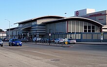
The San Bruno Planning Commission (then chaired by Peter Weinberger, brother of Caspar Weinberger) reviewed and approved plans for two major shopping centers, Bayhill (located on the old U.S. Navy property between San Bruno Avenue and Sneath Lane) and Tanforan.
With final approval from the San Bruno City Council, construction proceeded on these major retail developments.
Prior to these developments, most of the city's retail businesses were located on San Mateo Avenue and El Camino Real.
San Bruno is one of two cities in the Bay Area that manages its own cable TV and internet system.
Postal Service's Western Regional headquarters, which was then the tallest building in San Bruno, had to be demolished due to severe structural damage.
On September 9, 2010, at about 6:15 p.m. PDT, a gas line ruptured leading to a fire that severely damaged a residential neighborhood.
[53] The explosion, which took place two miles (3.2 km) west of San Francisco International Airport (37°37′23″N 122°26′31″W / 37.623°N 122.442°W / 37.623; -122.442 (September 2010 explosion and fire in San Bruno, California)), was initially thought to have been a plane crash, but the FAA and airport officials confirmed no downed aircraft was reported.
[64] During World War II the United States Navy established a base on what was a dairy opened by Richard Sneath.
[68] Due to the 1993 BRAC and its closure of neighboring bases although recommended for realignment, the Navy decided to close the facility, carrying through with its decision in October 1994.
The Pacific Region (San Francisco) facility of the National Archives and Records Administration was established.
[71][72] The rest of the facility was sold to a private developer who has since built multi-story apartment buildings on the former base.
[73] The 20-acre (81,000 m2) area of the former U.S. Navy complex is bounded by San Bruno Avenue, El Camino Real, Sneath Lane, and I-280.