San Francisco de Macorís
San Francisco de Macorís is a city in the Dominican Republic located in the northeast portion of the island, in the Cibao region.
By the beginning of the 18th century, foreign investment from Europeans created a market for the production of cocoa, allowing the locals to gain a new source of income apart from livestock.
On October 2, 1896, Ulises Heureaux reorganized the city of San Francisco de Macorís under the Provincial District "Pacificador" (Peacemaker).
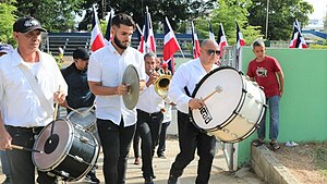
On 20 May 1963 the city council approved the renaming of the main streets of San Francisco de Macorís at the request of the Foundation Heroes of Constanza, Maimon and Estero Hondo.
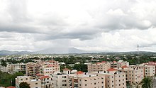
San Francisco de Macorís has hills to the north which provide a great view of the city during evening hours.
The city has the following subdivisions: The relief of Duarte Province ranges from 17 to 942 metres (56 to 3,091 ft) above sea level, reaching its highest elevation at "Loma Quita Espuela".
This name allegedly comes from the time when the Spaniards were exploring the island, since the hill was too steep to ride their horses, they had to dismount and remove their spurs and undertake the ascent on foot.
The Yuna River Delta is part of the Cibao Valley, and most of these areas are located a few metres above sea level and therefore wetlands abound.
Its main rivers are the Great Yuna and Caño Estero, which are the natural drainage of these lands in the province of Maria Trinidad Sanchez.
To the south of Gaspar Hernandez and reaching the Nagua River there is a very complex area with rugged hills of limestone, and tuff, probably with other volcanic and metamorphic rocks, mainly of Upper Cretaceous.
Similarly, the smoke from factories and from burning trash, specifically in the municipality of San Francisco de Macorís, is affecting its inhabitants.