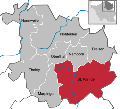
Sankt Wendel
It is situated on the river Blies 36 km northeast of Saarbrücken, the capital of Saarland, and is named after Saint Wendelin of Trier.
According to a survey by the German Association for Housing, Town Planning and Land Use Regulation, St. Wendel is known to be one of the wealthiest regions in Germany, behind Starnberg in Bavaria.
[citation needed] St. Wendel is situated on the river Blies west of the Bosenberg hill at an elevation of 938 feet (286 m).
The Lord of Blieskastel, whose properties stretched from the northern part of Lorraine all the way through the Hunsrück mountain chain to Bernkastel on the river Moselle (today Bernkastel-Kues), erected a castle surrounded by a moat in the valley of the Blies, which was intended to grant protection to the blooming pilgrimage site.
The castle consisted of an artificial hill of earth with a wooden tower on top, surrounded by a palisade and a moat.
In 1326/28 the prince elector and Archbishop Balduin of Luxembourg from Trier bought the castle and the village of St. Wendel.
Merchants from Saarbrücken and Strassburg met their needs for good cloth while the tanneries took their products to the fair in Frankfurt.
Besides many urban building activities took place, for example roads, the area around the castle, moving the cemetery away from the basilica to outside the former city wall.
In the Kelsweilerstrasse, the upper city gate was broken down and a bridge over the river Blies was erected in today's Bahnhofstrasse.
Beginning in 1816 he called this area the "Principality of Lichtenberg", which is still seen today in the borders of the evangelical church community of St. Wendel.
Creating a Landrat (senate for the district), the general public hoped to gain rights for self-rule, tax politics, etc., but Duke Ernst decided arbitrarily in too many cases.
In 1834 the duke sold the land to the Kingdom of Prussia and St. Wendel became a chief town of the administrative district of Trier.
Even today, there are towns in Brazil where the local German dialect of St. Wendel or even the surrounding villages is still spoken.
[4] In the middle of the 19th century, the town of St. Wendel and the nearby villages Alsfassen and Breiten slowly grew together.
The train maintenance company was first situated opposite the station on the Tholeyerberg; between 1913 and 1915 it was moved to the Schwarzer Weg (today Werkstrasse).
Also, as a reaction to the changes in economic and social structures, a major town expansion began, causing the inhabited area to double in size between 1910 and 1937.
During the Third Reich, a huge military base was built near the western town border beside Highway B269 to Winterbach.
Saarland remained a French protectorate independent from Germany until its re-integration into the Bundesrepublik Deutschland in 1957, which began an economic downturn as the largest employer of St. Wendel, the Marschall Tobacco Company, had to close down in 1960.
St. Wendel nowadays has about 26,000 residents due to a district reform in 1974 in which several surrounding villages were united with the town area.
The communal elections on May 25, 2014 produced these results:[6] Traditionally the CDU has been the strongest power in town, governing in each period with an absolute majority.
In 1465, the parish of St. Wendel sent two parishioners to Scotland to research the legend of Saint Wendelin's royal Scottish origins.