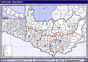
Saptari District
Saptari (Nepali: सप्तरी जिल्लाListenⓘ), is Located in the easternmost part of Madhesh Province, is one of the seventy-seven districts of Nepal.
The east-west length of the district covers 63% of the plains of the Terai and 37% of the chure region and the north-south width is an average of 23 km.
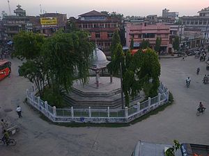
MapThere are nine municipalities in Saptari: Dakneshwori, Rajbiraj, Bodebarsain, Hanumannagar Kankalini, Kanchanrup, Saptakoshi, surunga, Shambhunath and Khadak.
Other small towns include Mahuli, Kathauna Fattepur, Pato and Itahari Bishnupur with the area government "Machha Palan Kendra" fish farming centre.
According to the legend, the people settled in Bhardaha village had started to use the land for farming, however, while digging, some farmers had found a stone statue carved beautifully with the image of Goddess Durga and in that very place, this temple is said to have been built.
[8] Ethnicity/caste: 15.8% were Yadav, 11.5% Tharu, 8.9% Musalman, 7.3% Teli, 6.5% Dhanuk, 6.1% Musahar, 5.9% Khatwe, 4.3% Chamar/Harijan/Ram, 2.3% Kathabaniyan, 2.2% Bantar/Sardar, 2.1% Mallaha, 2.0% other Terai, 1.9% Rajdhov, 1.8% Halwai, 1.7% Dusadh/Paswan/Pasi, 1.5% Hajam/Thakur, 1.5% Tatma/Tatwa, 1.4% Terai Brahmin, 1.4% Chhetri, 1.3% Hill Brahmin, 1.0% Koiri/Kushwaha, 0.9% Dhobi, 0.9% Kumhar, 0.8% Kalwar, 0.8% Kami, 0.6% Baraee, 0.6% Magar, 0.6% Rajput, 0.4% Newar, 0.3% Badhaee, 0.3% Dom, 0.3% Kayastha, 0.3% Kewat, 0.3% Rai, 0.3% Sonar, 0.3% Sudhi, 0.2% Bengali, 0.2% Damai/Dholi, 0.2% Danuwar, 0.2% Dev, 0.2% Gaderi/Bhedihar, 0.2% Kumal, 0.2% Mali, 0.2% Nuniya, 0.2% Rajbhar, 0.2% Sunuwar, 0.2% Tamang, 0.1% Amat, 0.1% Ghale, 0.1% Gharti/Bhujel, 0.1% Kurmi, 0.1% Limbu, 0.1% Lohar, 0.1% Marwadi, 0.1% Punjabi/Sikh, 0.1% Sanyasi/Dasnami, 0.1% Sarki and 0.4% others.