Sarlahi District
Sarlahi (Nepali: सर्लाही Listenⓘ; Maithili: सर्लाही), a part of Madhesh Province, is one of the seventy-seven districts of Nepal.
According to new laws, a combination of more than two or four villages makes a municipality, which covers an area of 1,259 km2 (486 sq mi) and had a population of 635,701 in 2001,769,729 in 2011 and 862,470 in 2021 .
The biggest Tropical Horticulture center of Nepal also known as Ushnapradesiya Bagwani kendra lies in the Labandi municipality of the district.
The plant commenced trial operations on January 17, 2014, with a successful crushing of over 16 lakh quintals (160,000 tons) of cane.
It helps to support the livelihood of thousands of people including farmers, employees and laborers.
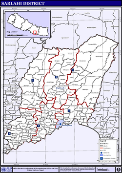
[5] On the north side of the district from east to west is the mountain range known as the Sivalik Hills.
[5] The Terai region, plains, forms the southernmost part of Nepal and goes to India's Bihar.
Since ancient times, the region has had large public density and is a good place for farming, so it is called Treasurer of grain.
[8] Ethnicity/caste: 15.5% were Yadav, 7.9% Koiri/Kushwaha, 7.9% Musalman, 5.4% Teli, 5.2% Tamang, 3.7% Chhetri, 3.7% Dusadh/Paswan/Pasi, 3.6% Hill Brahmin, 3.6% Chamar/Harijan/Ram, 2.8% Tharu, 2.7% Mallaha, 2.6% Kalwar, 2.2% Kathabaniyan, 2.2% Kurmi, 2.0% Magar, 1.9% Terai Brahmin, 1.8% Musahar, 1.7% Lohar, 1.6% Dhanuk, 1.4% Kumhar, 1.3% Dhobi, 1.3% Hajam/Thakur, 1.3% Kanu, 1.2% Bin, 1.2% Nuniya, 1.2% Tatma/Tatwa, 1.1% Danuwar, 1.1% Sonar, 1.0% Newar, 1.0% Sudhi, 0.9% Kami, 0.9% Khatwe, 0.8% Rajput, 0.7% Baraee, 0.6% Majhi, 0.5% Halwai, 0.5% Kewat, 0.4% Kayastha, 0.4% Sanyasi/Dasnami, 0.3% Damai/Dholi, 0.3% Gharti/Bhujel, 0.3% Marwadi, 0.2% Dhunia, 0.2% Mali, 0.2% Rai, 0.2% Sarki, 0.2% other Terai, 0.1% Badhaee, 0.1% Bote, 0.1% Dom, 0.1% Gaderi/Bhedihar, 0.1% Kahar, 0.1% Kumal, 0.1% Punjabi/Sikh, 0.1% Sunuwar, 0.1% Thakuri and 0.2% others.