Scheduled monuments in Lancashire
In the United Kingdom, a scheduled monument is a "nationally important" archaeological site or historic building that has been given protection against unauthorised change by being placed on a list (or "schedule") by the Secretary of State for Digital, Culture, Media and Sport; Historic England takes the leading role in identifying such sites.
If a monument is considered by Historic England to "no longer merit scheduling" it can be descheduled.
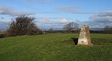
[2] Lancashire has over 140 scheduled monuments including burial mounds, Roman remains, medieval sites, mining relics, castles and various bridges.
53°55′42″N 2°28′09″W / 53.9283°N 2.4691°W / 53.9283; -2.4691 (Ashnott lead mine and lime kiln) 54°03′19″N 2°43′25″W / 54.0552°N 2.7236°W / 54.0552; -2.7236 (Askew Heights univallate prehistoric defended enclosure and hollow way) 54°08′56″N 2°47′41″W / 54.1489°N 2.7947°W / 54.1489; -2.7947 (Badger Hole, Warton Crag) 53°49′52″N 2°29′24″W / 53.8311°N 2.4900°W / 53.8311; -2.4900 (Bailey Hall moated site) 53°48′11″N 2°10′08″W / 53.8031°N 2.1689°W / 53.8031; -2.1689 (Beadle Hill Romano-British farmstead) 53°53′10″N 2°22′07″W / 53.8861°N 2.3685°W / 53.8861; -2.3685 (Bellmanpark lime kilns) 53°54′17″N 2°06′47″W / 53.9046°N 2.1131°W / 53.9046; -2.1131 (Bleara Lowe round cairn) 53°54′30″N 2°38′43″W / 53.9084°N 2.6452°W / 53.9084; -2.6452 (Bleasdale Circle) 53°35′42″N 2°43′48″W / 53.5949°N 2.7301°W / 53.5949; -2.7301 (Boar's Den bowl barrow) 53°55′28″N 2°14′26″W / 53.9245°N 2.2406°W / 53.9245; -2.2406 (Bomber Camp Romano-British farmstead) 53°49′52″N 2°26′40″W / 53.8312°N 2.4444°W / 53.8312; -2.4444 (Bowl barrow 170m north east of Hacking Boat House) 53°49′57″N 2°26′51″W / 53.8325°N 2.4475°W / 53.8325; -2.4475 (Bowl barrow 250m north of Hacking Boat House) 53°48′11″N 2°09′59″W / 53.8030°N 2.1663°W / 53.8030; -2.1663 (Bowl barrow 140m east of Beadle Hill) 53°48′12″N 2°09′58″W / 53.8032°N 2.1660°W / 53.8032; -2.1660 (Bowl barrow 155m east of Beadle Hill) 53°47′59″N 2°10′08″W / 53.7996°N 2.1688°W / 53.7996; -2.1688 (Bowl barrow 90m east of Twist Castle) 54°02′19″N 2°22′26″W / 54.0386°N 2.3738°W / 54.0386; -2.3738 (Bowl barrow west of Brown Hills Beck) 54°02′15″N 2°22′24″W / 54.0376°N 2.3733°W / 54.0376; -2.3733 (Bowl barrow east of Brown Hills Beck) 53°47′23″N 2°09′59″W / 53.7898°N 2.1663°W / 53.7898; -2.1663 (Bowl barrow on Hameldon Pasture) 53°38′57″N 2°42′41″W / 53.6491°N 2.7113°W / 53.6491; -2.7113 (Bradley Hall, moated site, fishponds and connecting channels) 53°38′01″N 2°36′27″W / 53.6336°N 2.6076°W / 53.6336; -2.6076 (Bretters Farm moated site and two fishponds) 53°54′23″N 2°39′43″W / 53.9065°N 2.6620°W / 53.9065; -2.6620 (Brooks Farm packhorse bridge) 53°34′58″N 2°51′24″W / 53.5828°N 2.8567°W / 53.5828; -2.8567 (Burscough Priory) 53°48′48″N 2°08′59″W / 53.8132°N 2.1497°W / 53.8132; -2.1497 (Burwains Camp prehistoric defended settlement west of Broad Bank Hill) 54°06′08″N 2°39′22″W / 54.1022°N 2.6561°W / 54.1022; -2.6561 (Camp House moated site, moated outwork & connecting channels) 53°50′30″N 2°10′35″W / 53.8417°N 2.1764°W / 53.8417; -2.1764 (Castercliff small multivallate hillfort) 53°57′10″N 2°15′38″W / 53.9528°N 2.2606°W / 53.9528; -2.2606 (Castle Haugh Ringwork) 53°45′21″N 2°43′21″W / 53.7558°N 2.7226°W / 53.7558; -2.7226 (Castle Hill motte) 54°04′36″N 2°45′58″W / 54.0767°N 2.7661°W / 54.0767; -2.7661 (Castle Hill motte and bailey, Halton) 53°58′35″N 2°43′57″W / 53.9764°N 2.7326°W / 53.9764; -2.7326 (Castle Hill motte, Dolphinholme) 54°11′45″N 2°32′15″W / 54.1959°N 2.5374°W / 54.1959; -2.5374 (Castle Hill prehistoric defended enclosure) 54°08′05″N 2°36′57″W / 54.1347°N 2.6157°W / 54.1347; -2.6157 (Castle Mound motte and bailey, Melling) 54°07′19″N 2°38′23″W / 54.1220°N 2.6397°W / 54.1220; -2.6397 (Castle Stede motte and bailey, Hornby) 54°07′19″N 2°38′23″W / 54.1220°N 2.6397°W / 54.1220; -2.6397 (Chapel Hill Motte, Arkholme) 53°49′00″N 2°40′29″W / 53.8167°N 2.6746°W / 53.8167; -2.6746 (Chingle Hall moated site) 53°52′34″N 2°44′33″W / 53.8761°N 2.7424°W / 53.8761; -2.7424 (Claughton hlaew) 54°07′20″N 2°34′09″W / 54.1223°N 2.5692°W / 54.1223; -2.5692 (Clintsfield Colliery) 53°52′12″N 2°23′36″W / 53.8700°N 2.3934°W / 53.8700; -2.3934 (Clitheroe Castle) 53°58′36″N 2°52′29″W / 53.9766°N 2.8748°W / 53.9766; -2.8748 (Cockersand Premonstratensian Abbey) 53°40′21″N 2°24′19″W / 53.6724°N 2.4054°W / 53.6724; -2.4054 (Coking ovens and associated coal workings on Aushaw Moss) 53°47′55″N 2°41′44″W / 53.7987°N 2.6955°W / 53.7987; -2.6955 (Cromwell's Mound Civil War fieldwork) 53°34′02″N 2°51′52″W / 53.5672°N 2.8645°W / 53.5672; -2.8645 (Cross Hall moated site) 53°39′37″N 2°46′26″W / 53.6602°N 2.7738°W / 53.6602; -2.7738 (Croston Town Bridge) 54°09′02″N 2°47′33″W / 54.1505°N 2.7925°W / 54.1505; -2.7925 (Dog Holes Cave) 53°51′12″N 2°52′28″W / 53.8534°N 2.8744°W / 53.8534; -2.8744 (Dovecote at Great Eccleston) 53°53′45″N 2°19′21″W / 53.8959°N 2.3225°W / 53.8959; -2.3225 (Downham lime kiln and associated lime yard) 53°52′07″N 2°25′04″W / 53.8685°N 2.4177°W / 53.8685; -2.4177 (Eadsford (or Edisford) Bridge) 53°34′11″N 2°48′25″W / 53.5698°N 2.8070°W / 53.5698; -2.8070 (Earthworks in Spa Roughs Wood) 53°54′00″N 2°46′28″W / 53.9001°N 2.7744°W / 53.9001; -2.7744 (Garstang market cross) 54°02′57″N 2°48′13″W / 54.0493°N 2.8036°W / 54.0493; -2.8036 (Glass melting and annealing workshop) 53°59′56″N 2°50′57″W / 53.9990°N 2.8491°W / 53.9990; -2.8491 (Glasson Dock) 53°59′52″N 2°50′52″W / 53.9978°N 2.8477°W / 53.9978; -2.8477 (Glasson Dock) 53°53′59″N 2°45′41″W / 53.8997°N 2.7615°W / 53.8997; -2.7615 (Greenhalgh Castle) 53°35′15″N 2°57′02″W / 53.5874°N 2.9505°W / 53.5874; -2.9505 (Halsall medieval rectory) 53°45′05″N 2°17′27″W / 53.7515°N 2.2909°W / 53.7515; -2.2909 (Hameldon Hill World War II bombing decoy, 390m north of Heights Farm) 53°50′27″N 2°02′43″W / 53.8407°N 2.0452°W / 53.8407; -2.0452 (Hanging Stone or Watersheddles Cross)
53°46′45″N 2°19′21″W / 53.7792°N 2.3226°W / 53.7792; -2.3226 (Hapton Castle) 53°36′44″N 2°34′39″W / 53.6122°N 2.5775°W / 53.6122; -2.5775 (Headless Cross, Grimeford) 54°02′50″N 2°54′06″W / 54.0471°N 2.9017°W / 54.0471; -2.9017 (High cross in St Peter's churchyard, Heysham) 54°04′33″N 2°46′01″W / 54.0758°N 2.7669°W / 54.0758; -2.7669 (High cross in St Wilfrid's churchyard, Halton) 53°41′24″N 2°20′19″W / 53.6899°N 2.3386°W / 53.6899; -2.3386 (Higher Mill, Helmshore) 53°41′23″N 2°20′15″W / 53.6896°N 2.3375°W / 53.6896; -2.3375 (Higher Mill, Helmshore) 53°51′28″N 2°12′38″W / 53.8577°N 2.2105°W / 53.8577; -2.2105 (Higherford Old Bridge) 54°06′35″N 2°38′09″W / 54.1097°N 2.6359°W / 54.1097; -2.6359 (Hornby Bridge) 53°46′29″N 2°13′33″W / 53.7748°N 2.2257°W / 53.7748; -2.2257 (Ice house at Towneley Hall) 53°48′08″N 2°16′36″W / 53.8022°N 2.2767°W / 53.8022; -2.2767 (Ightenhill Manor) 53°39′29″N 2°44′20″W / 53.6580°N 2.7389°W / 53.6580; -2.7389 (Ingrave Farm moated site, moated site 100m W of Ingrave Farm and connecting channel, Eccleston) 53°54′54″N 2°29′31″W / 53.9149°N 2.4920°W / 53.9149; -2.4920 (Length of Roman road N of Bateson's Farm) 53°56′49″N 2°15′46″W / 53.9469°N 2.2629°W / 53.9469; -2.2629 (Little Painley bowl barrow) 54°07′18″N 2°38′29″W / 54.1217°N 2.6415°W / 54.1217; -2.6415 (Loyn Bridge) 53°56′27″N 2°20′50″W / 53.9407°N 2.3472°W / 53.9407; -2.3472 (Moated site 50m north-east of Holden Green Farm) 54°09′38″N 2°42′42″W / 54.1606°N 2.7116°W / 54.1606; -2.7116 (Moated site and fishponds E of Upp Hall Farm) 53°41′37″N 2°47′59″W / 53.6935°N 2.7998°W / 53.6935; -2.7998 (Moated site and two fishponds south of Manor House Farm) 53°31′45″N 2°50′28″W / 53.5293°N 2.8411°W / 53.5293; -2.8411 (Moated site at Bickerstaffe Hall) 53°41′35″N 2°39′39″W / 53.6930°N 2.6609°W / 53.6930; -2.6609 (Moated site of Clayton Hall, adjacent fishponds and channels) 53°36′30″N 2°55′20″W / 53.6083°N 2.9221°W / 53.6083; -2.9221 (Moated site of Scarisbrick Hall) 53°54′06″N 2°17′05″W / 53.9016°N 2.2848°W / 53.9016; -2.2848 (Rimington lead mines, part of a medieval open field system and three limestone clamp kilns) 53°47′24″N 2°15′07″W / 53.7899°N 2.2520°W / 53.7899; -2.2520 (Oakmount Mill) 53°50′52″N 2°27′04″W / 53.8478°N 2.4512°W / 53.8478; -2.4512 (The Old Lower Hodder Bridge) 54°03′05″N 2°48′21″W / 54.0514°N 2.8057°W / 54.0514; -2.8057 (Castle Hill, Lancaster) 53°57′26″N 2°15′33″W / 53.9572°N 2.2591°W / 53.9572; -2.2591 (Paythorne Bridge) 53°44′55″N 2°42′50″W / 53.7487°N 2.7140°W / 53.7487; -2.7140 (Penwortham Old Bridge) 53°48′15″N 2°09′42″W / 53.8042°N 2.1618°W / 53.8042; -2.1618 (Pike Low bowl barrow and site of beacon, Bonfire Hill) 53°39′00″N 2°33′57″W / 53.6499°N 2.5657°W / 53.6499; -2.5657 (Pike Stones chambered long cairn) 53°44′54″N 2°33′20″W / 53.7484°N 2.5555°W / 53.7484; -2.5555 (Pleasington alum works) 53°48′54″N 2°23′15″W / 53.8151°N 2.3875°W / 53.8151; -2.3875 (Portfield hillfort) 54°06′38″N 2°35′48″W / 54.1106°N 2.5967°W / 54.1106; -2.5967 (Prehistoric defended enclosure and six adjacent hut circles at Tatham Park) 54°11′52″N 2°33′00″W / 54.1978°N 2.5499°W / 54.1978; -2.5499 (Early settlements, field systems and a deer park at High Park) 53°45′08″N 2°23′59″W / 53.7523°N 2.3998°W / 53.7523; -2.3998 (Remains of Aspen Colliery) 53°58′25″N 2°43′59″W / 53.9737°N 2.7330°W / 53.9737; -2.7330 (Remains of Dolphinholme Worsted Mill) 53°48′33″N 2°32′05″W / 53.8091°N 2.5346°W / 53.8091; -2.5346 (Ribchester Roman fort)53°48′40″N 2°32′02″W / 53.8112°N 2.5340°W / 53.8112; -2.5340 (Ribchester Roman fort)53°48′38″N 2°31′59″W / 53.8106°N 2.5330°W / 53.8106; -2.5330 (Ribchester Roman fort)53°48′42″N 2°31′54″W / 53.8118°N 2.5316°W / 53.8118; -2.5316 (Ribchester Roman fort)53°48′47″N 2°31′52″W / 53.8131°N 2.5312°W / 53.8131; -2.5312 (Ribchester Roman fort) 53°48′13″N 2°09′05″W / 53.8035°N 2.1514°W / 53.8035; -2.1514 (Ring cairn 25m east of Ell Clough) 53°47′28″N 2°10′36″W / 53.7911°N 2.1767°W / 53.7911; -2.1767 (Ring cairn on Slipper Hill) 54°10′41″N 2°35′43″W / 54.1780°N 2.5953°W / 54.1780; -2.5953 (Roman fort and civil settlement, Over Burrow)54°10′42″N 2°35′21″W / 54.1782°N 2.5892°W / 54.1782; -2.5892 (Roman fort and civil settlement, Over Burrow) 53°35′28″N 2°50′09″W / 53.5910°N 2.8358°W / 53.5910; -2.8358 (Burscough Roman fort) 54°01′40″N 2°43′49″W / 54.0277°N 2.7304°W / 54.0277; -2.7304 (Roman kilns 25yds (20m) NE of Fairyhill Cottage) 54°10′45″N 2°34′05″W / 54.1792°N 2.5681°W / 54.1792; -2.5681 (Roman milestone) 53°38′07″N 2°23′16″W / 53.6352°N 2.3879°W / 53.6352; -2.3879 (Roman road at Bottom o' th' Knotts Brow) 53°44′56″N 2°40′54″W / 53.7489°N 2.6816°W / 53.7489; -2.6816 (Roman settlement and industrial area at Winery Lane)53°44′50″N 2°40′53″W / 53.7473°N 2.6813°W / 53.7473; -2.6813 (Roman settlement and industrial area at Winery Lane)53°44′57″N 2°40′50″W / 53.7493°N 2.6806°W / 53.7493; -2.6806 (Roman settlement and industrial area at Winery Lane) 53°46′37″N 2°31′16″W / 53.7769°N 2.5211°W / 53.7769; -2.5211 (Roman signal station on Mellor Moor) 54°10′05″N 2°33′18″W / 54.1681°N 2.5551°W / 54.1681; -2.5551 (Romano-British enclosed hut circle settlement 375m ENE of Collingholme) 54°08′57″N 2°43′50″W / 54.1493°N 2.7306°W / 54.1493; -2.7306 (Round cairn 230m east of Manor Farm) 53°54′17″N 2°07′00″W / 53.9047°N 2.1167°W / 53.9047; -2.1167 (Round cairn 230m west of Bleara Lowe) 53°47′23″N 2°10′00″W / 53.7896°N 2.1666°W / 53.7896; -2.1666 (Round cairn on Hameldon Pasture) 53°37′49″N 2°32′07″W / 53.6302°N 2.5353°W / 53.6302; -2.5353 (Round cairn on Noon Hill) 53°53′59″N 2°37′00″W / 53.8998°N 2.6167°W / 53.8998; -2.6167 (Round cairn on Parlick Pike) 54°09′43″N 2°45′54″W / 54.1619°N 2.7650°W / 54.1619; -2.7650 (Round cairn on Summerhouse Hill) 53°51′33″N 2°32′27″W / 53.8592°N 2.5408°W / 53.8592; -2.5408 (Round cairn on Thornley Hall Fell) 53°37′50″N 2°31′19″W / 53.6305°N 2.5220°W / 53.6305; -2.5220 (Round cairn on Winter Hill) 53°39′33″N 2°32′57″W / 53.6592°N 2.5493°W / 53.6592; -2.5493 (Round Loaf bowl barrow on Anglezarke Moor) 53°38′54″N 2°49′18″W / 53.6482°N 2.8217°W / 53.6482; -2.8217 (Rufford moated site) 53°48′12″N 2°09′01″W / 53.8033°N 2.1503°W / 53.8033; -2.1503 (Saucer barrow 90m east of Ell Clough) 53°54′42″N 2°20′22″W / 53.9117°N 2.3395°W / 53.9117; -2.3395 (Sawley Cistercian abbey) 53°36′04″N 2°55′36″W / 53.6012°N 2.9268°W / 53.6012; -2.9268 (Scarisbrick Park holy well) 53°36′04″N 2°55′37″W / 53.6010°N 2.926916°W / 53.6010; -2.926916 (Scarisbrick Park wayside cross) 54°11′25″N 2°36′24″W / 54.1902°N 2.6067°W / 54.1902; -2.6067 (Sellet Bank prehistoric defended enclosure) 53°57′29″N 2°15′06″W / 53.9581°N 2.2516°W / 53.9581; -2.2516 (Site of the Old Hall) 54°03′16″N 2°47′47″W / 54.0545°N 2.7965°W / 54.0545; -2.7965 (Skerton Bridge) 53°47′59″N 2°09′08″W / 53.7998°N 2.1523°W / 53.7998; -2.1523 (Small stone circle on Delf Hill) 53°47′07″N 2°18′46″W / 53.7853°N 2.3129°W / 53.7853; -2.3129 (Spigot mortar (Blacker Bombard) position) 54°02′51″N 2°54′10″W / 54.0475°N 2.9028°W / 54.0475; -2.9028 (St Patrick's early Christian chapel) 53°40′49″N 2°27′32″W / 53.6804°N 2.4589°W / 53.6804; -2.4589 (Steam tramway reversing triangle) 53°56′09″N 2°12′09″W / 53.9358°N 2.2026°W / 53.9358; -2.2026 (Stock medieval settlement and part of its associated medieval open field system) 54°09′45″N 2°46′04″W / 54.1626°N 2.7679°W / 54.1626; -2.7679 (Stone circle on Summerhouse Hill)54°09′46″N 2°46′00″W / 54.1627°N 2.7666°W / 54.1627; -2.7666 (Stone circle on Summerhouse Hill)54°09′43″N 2°45′56″W / 54.1620°N 2.7655°W / 54.1620; -2.7655 (Stone circle on Summerhouse Hill) 53°38′19″N 2°25′49″W / 53.6385°N 2.4302°W / 53.6385; -2.4302 (Stone circle, ring cairn and two round cairns on Cheetham Close) 53°44′48″N 2°12′05″W / 53.7466°N 2.2015°W / 53.7466; -2.2015 (Thieveley lead mine)53°44′46″N 2°11′37″W / 53.7462°N 2.1937°W / 53.7462; -2.1937 (Thieveley lead mine) 53°50′52″N 2°27′04″W / 53.8478°N 2.4512°W / 53.8478; -2.4512 (Three high crosses in St Mary's churchyard) 54°04′17″N 2°49′38″W / 54.0713°N 2.8272°W / 54.0713; -2.8272 (Torrisholme bowl barrow) 53°47′58″N 2°10′14″W / 53.7995°N 2.1705°W / 53.7995; -2.1705 (Twist Castle Romano-British farmstead) 53°53′44″N 2°17′31″W / 53.8955°N 2.2920°W / 53.8955; -2.2920 (Twiston lime kiln) 53°47′36″N 2°10′26″W / 53.7932°N 2.1738°W / 53.7932; -2.1738 (Two Romano-British farmsteads known as Ring Stones) 54°05′28″N 2°39′17″W / 54.0910°N 2.6547°W / 54.0910; -2.6547 (Univallate prehistoric defended enclosures and hollow way near Claughton Hall) 53°32′24″N 2°43′16″W / 53.5400°N 2.7212°W / 53.5400; -2.7212 (Up Holland Benedictine priory) 53°46′06″N 2°13′49″W / 53.7684°N 2.2303°W / 53.7684; -2.2303 (Warren at Everage Clough) 53°45′59″N 2°13′44″W / 53.7664°N 2.2288°W / 53.7664; -2.2288 (Warren at Everage Clough) 53°46′02″N 2°13′42″W / 53.7672°N 2.2284°W / 53.7672; -2.2284 (Warren at Everage Clough) 54°08′57″N 2°46′44″W / 54.1492°N 2.7789°W / 54.1492; -2.7789 (Warton Crag small multivallate hillfort) 54°08′39″N 2°46′06″W / 54.1443°N 2.7683°W / 54.1443; -2.7683 (Warton Old Rectory) 53°49′07″N 2°24′26″W / 53.8187°N 2.4072°W / 53.8187; -2.4072 (Whalley Bridge) 53°49′16″N 2°24′47″W / 53.8212°N 2.4131°W / 53.8212; -2.4131 (Whalley Cistercian abbey)53°49′12″N 2°24′37″W / 53.8201°N 2.4103°W / 53.8201; -2.4103 (Whalley Cistercian abbey) 54°10′50″N 2°36′54″W / 54.1806°N 2.6151°W / 54.1806; -2.6151 (Whittington motte and bailey castle) 53°44′27″N 2°30′38″W / 53.7407°N 2.5105°W / 53.7407; -2.5105 (Part of Witton Old Hall medieval lordly residence) 53°50′47″N 2°05′56″W / 53.8463°N 2.0989°W / 53.8463; -2.0989 (Bank House Bridge, Wycoller) 53°50′56″N 2°06′14″W / 53.8490°N 2.1038°W / 53.8490; -2.1038 (Wycoller Hall) 53°50′56″N 2°06′16″W / 53.8490°N 2.1044°W / 53.8490; -2.1044 (The Hall Bridge, Wycoller) 53°50′58″N 2°06′15″W / 53.8494°N 2.1043°W / 53.8494; -2.1043 (Wycoller packhorse bridge)