Scheduled monuments in Somerset
[1] Bath and North East Somerset occupies an area of 220 square miles (570 km2), two-thirds of which is green belt.
[3] The city of Bath is the principal settlement in the district, but BANES also covers Keynsham, Midsomer Norton, Radstock and the Chew Valley.
[5] There are also several Iron Age hill forts such as the one at Maes Knoll,[6] which is connected to the Wansdyke medieval defensive earthwork, several sections of which are included in this list.
Two major religious sites in Mendip at Glastonbury Abbey and Wells Cathedral and their precincts and dispersed residences, tithe barns and The Abbot's Fish House also figure prominently in the list.
The most recent monuments are World War II bunkers and bombing decoys on Black Down the highest point of the Mendip Hills,[22][23] which also appear on the Sedgemoor list as the site crosses the boundary between the districts.
Some of the oldest are Neolithic including Aveline's Hole, a cave which is the earliest scientifically dated cemetery in Britain,[24] and several tumuli.
[27] Sedgemoor district is a low-lying area of land close to sea level between the Quantock and Mendip hills, historically largely marsh (or moor).
It contains the bulk of the area also known as the Somerset Levels, including Europe's oldest known engineered roadway, the Sweet Track.
The district of Taunton Deane covers a population of approximately 100,000[44] in an area of 462 square kilometres (178 sq mi).
[45] It is centred on the town of Taunton, where around 60,000 of the population live[44] and the council are based, and includes surrounding suburbs and villages.
Many of them are Neolithic through to the Bronze and Iron Ages such as bowl barrows, cairns along with hill forts such as Norton Camp.
[49] It was presented, in 1946, by Major Alexander Gould Barrett, to the National Trust and serves as a memorial to the 11,281[50] Somerset men who lost their lives during the first and second world wars.
The defensive walls and part of Taunton Castle, which has Anglo-Saxon origins and was expanded during the Medieval and Tudor eras, are included.
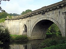
[52][53] More recent sites include Poundisford Park, Buckland Priory, Bradford Bridge and a duck decoy from the 17th century.
The most recent are air traffic control buildings, pillboxes and fighter pens from RAF Culmhead, situated at Churchstanton on the Blackdown Hills.
After the Norman conquest of England in the 11th century, William de Mohun constructed a timber castle on the site as part of the pacification of Somerset.
A stone shell keep was built on the motte by the start of the 12th century, and the castle survived a siege during the early years of the Anarchy.
[58] In 1976 Colonel Walter Luttrell gave Dunster Castle and most of its contents to the National Trust, which operates it as a tourist attraction.
Other sites of religious significance include Cleeve Abbey which was founded by William de Roumare, Earl of Lincoln[60][61] in a grant of 1191, on land he had been given by king Æthelred the Unready.
The village of Dunster provides the highest concentration of monuments ranging from Iron Age forts to the castle and Yarn Market which was built around 1600.