Scilly naval disaster of 1707
[a] Between 1,400 and 2,000 sailors lost their lives aboard the wrecked vessels, making the incident one of the worst maritime disasters in British naval history.
[2] The disaster has been attributed to a combination of factors, including the navigators' inability to accurately calculate their positions, errors in the available charts and pilot books, and inadequate compasses.
[3] From 29 July to 21 August 1707, during the War of the Spanish Succession, a combined British, Austrian and Dutch force under the command of Prince Eugene of Savoy besieged the French port of Toulon.
As the fleet sailed out on the Atlantic, passing the Bay of Biscay on their way to England, the weather worsened, and on most days it was impossible to take the observations needed to determine their latitude.
[6] At noon that day the weather cleared and good readings of latitude were obtained, at 48° 50–57' N. Taken together these observations suggested a location about 200 miles west-southwest of Scilly.
[7] The fleet headed east-by-north until at about 8 PM the flagship and several other vessels found themselves among the rocks to the southwest of St Agnes Island in the Isles of Scilly.
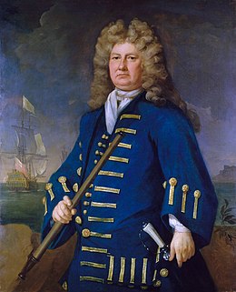
[17] Admiral Shovell's body, along with those of his two Narborough stepsons and his flag-captain, Edmund Loades, washed up on Porthellick Cove on St Mary's the following day, almost seven miles (11 km) from where Association was wrecked.
[18] Another myth associated with the disaster alleges that a common sailor on the flagship tried to warn Shovell that the fleet was off course but the Admiral had him hanged at the yardarm for inciting mutiny.
Naval historians have repeatedly discredited the story, noting the lack of any evidence in contemporary documents, its fanciful stock conventions and dubious origins.
[20]: 11–16 Another story that is often told is that Shovell was alive, at least barely, when he reached the shore of Scilly at Porthellick Cove, but was murdered by a woman for the sake of his priceless emerald ring, which had been given to him by a close friend, Captain James Lord Dursley.
[15] According to a letter written in 1709 by Edmund Herbert, who was sent to Scilly by Shovell's family to help locate and recover items belonging to the admiral, Sir Cloudesley's body was first found by two women "stript of his shirt" and "his ring was also lost off his hand, which however left ye impression on his finger."
[20] The clergyman supposedly sent it back to the 3rd Earl of Berkeley,[21] although several historians doubt the murder legend as there is no record of the ring's return and the story stems from a romantic and unverifiable "deathbed confession".
He identified two factors responsible for the mistakes: the failure to take account of magnetic variation, then about 7° west, and errors in the pilot books, which placed the islands up to 15 miles north of their true position.
[23][7] Writing about the Scilly disaster in 1720, Josiah Burchett wrote: "I cannot but have a lively idea of the danger fleets are exposed to upon entering the British Channel, when coming from foreign parts, but more especially when their officers have not the advantage of knowing their latitude by a good observation".
[28] While Dava Sobel's[20] assertion that the disaster was mainly due to an error in longitude cannot be sustained, the disastrous wrecking of a Royal Navy fleet in home waters nonetheless caused great consternation to the nation, and made plainly evident the inadequacy of existing maritime navigational techniques.
After many years, the consequence of the Act was that accurate marine chronometers were produced and the lunar distance method was developed, both of which were quickly adopted worldwide for maritime navigation.
He recalled some years later: "The weather was so bad, all we achieved was the sight of a blur of seaweed, seals and white water as we were swept through the Gilstone Reef and fortunately out the other side.
"[14][35] On their second attempt in summer 1967, using the minesweeper and supported by the Royal Navy Auxiliary Service, Graham and his men finally managed to locate the remains of Admiral Shovell's flagship on the Gilstone Ledge.
[35] The Ministry of Defence initially suppressed news of the discovery for fear of attracting treasure hunters, but word was soon out and excited huge national interest.
[17] The wreck of Firebrand was discovered in 1982, and several items were recovered, including guns and anchors, a wooden nocturne (for determining the time at night), a bell and carved cherubs.
[40] Today photographs of the original diving expedition are on display at the Old Wesleyan Chapel in St. Mary's, of the team leader Lt Graham and a naval doctor examining human bones from the wreck of Association, alongside the ship's bell of Firebrand with "1692" engraved on it, and many more artefacts.