Semna (Nubia)
Semna and Kumma also included the remains of temples, houses and cemeteries dating to the New Kingdom (1550–1069 BC), which would have been roughly contemporary with such lower Nubian towns as Amara West and Sesebisudla, when the second cataract region had become part of an Egyptian 'empire', rather than simply a frontier zone.
As Reisner (1929) notes, “the southern products, the ebony, the ivory, the pelts, the incense and resin, the ostrich feathers, the black slaves, were as much desired by the kings of the Middle Kingdom as by their forebears”.
[5] Thus, forts were built along the Nile to protect the waterway from nomadic tribes and to facilitate the flow of Nubian goods into Egypt.
[2] Further excavations of the fort and an adjacent cemetery were conducted by the Oriental Institute Expedition to Sudanese Nubia, under the direction of Dr. Louis Vico Žabkar, in 1966–1968.
As its name implies, the Batn-El-Hajar is “characterized by ‘bare granite ridges and gullies’, a narrowed Nile run, and heavy deposits of wind-blown sand".
[2] This excavation explored the majority (four-fifths) of the fort and “made a limited trial digging” in the adjacent Meroitic cemetery.
Between 1966 and 1968 the University of Chicago Oriental Institute Expedition to Sudanese Nubia excavated the remainder of the Semna South fort and the adjacent cemetery.
However, they did provide a hypothetical estimate: “the church in its final, that is apsidal, form would date to the classic Christian period in Nubia, somewhere between the ninth and the first part of the eleventh century A.D.".
An area located on the fort's north-west side previously called a ‘graveyard,’ ‘occupation site,’ or an ‘encampment,’ and covered in pot sherds was also excavated during the 1966–1968 field seasons.
[18][7] Within these holes, the discarded objects and pottery sherds were mixed into a loose mass of debris with no discernible stratigraphic layers.
[18] Prior to this seal being found, the Egyptian name of the fort at Semna South was written in hieratic as “Repressing the…” on a fragmentary piece of papyrus discovered in 1896 by James Quibell near the Ramesseum.
[18][9] This find is important because it officially confirms the Egyptian name of the fort at Semna South and clarifies the fragmentary name written on the Ramesseum papyrus.
[7] For those remains found in situ, the heads were oriented to the west and the bodies were extended on their backs with hands over the pelvis.
[24] For the remains found in situ, the bodies were in a flexed position on their sides with the heads facing towards the north, northwest, or south.
[24] Objects recovered from these graves are as follows: red ware pottery; jewelry; personal grooming tools; hunting equipment; leather sandals; and clothing.
[26] In 1993, Arriaza, Merbs, and Rothschild published a study evaluating the prevalence of a pathological condition known as diffuse idiopathic skeletal hyperostosis (DISH).
[18][9] The artifacts recovered from these excavations, including pottery sherds, textiles, jewelry, an axe, and additional seals, indicate that the fort at Semna South was utilized during the Middle Kingdom.
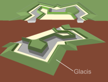
These forts established military control over Upper and Lower Nubia and the Nile river transport of commodities, and were integral parts of the Egyptian empire.
The temples of Dedwen and Sesostris III were moved to the National Museum of Sudan in Khartoum prior to the flooding of Lake Nasser.